Search

Sunday, January 3, 2010

Hetauda city

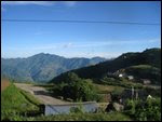
Hetauda (हेटौडा) is a small town and municipality and seat of Makwanpur District in the Narayani Zone of southern Nepal. At the time of the 1991 Nepal census it had a population of 53,836 people living in 10,420 individual households.[1]It is 132 km from the capital Kathmandu via the old Tribhuwan Highway. There are now two alternate roads that are less than 80 km. They are, however, not black topped yet. The city is enclosed by three rivers, the Rapti to the west, the Samari to the north and the Karra to the south. It is one the important industrial regions of Nepal. The settlement could have started due to its location at the meeting point of two major highways - East-West Highway and Tribhuwan Rajpath.

Contents[hide]1 Physiography 2 Transport 2.1 Road 2.2 Railways 3 References 4 External links 5 External links [edit] PhysiographyHetauda is one of the cleanest and greenest cities in Nepal. Due to its geographical features and its climate, it has been a popular choice for people migrating from the northern hilly regions to the south and. Hetauda is a doon, which means that it has a valley like geography. It is surrounded by hills: the Mahabharata range in the north and the Siwalik range in the south. The rivers Rapti, Samari, and Karra run through this area and flow southwest to meet Narayani, one of the bigger and popular rivers in the nation.It is an hour's drive from the Nepalese border city of Birgunj, which is adjacent to its Indian counterpart, Raxaul. Both the existing highways to the capital city Kathmandu - Tribhuwan Highway and the East-West Highway, aka Mahendra Highway that trails the length of the nation - traverse through this city. With so many entry and exit points leading in and out of this town, Hetauda is set to grow into a commercial powerhouse if only the country realized its potential.Hetauda is also popular for its industries. Hetauda Industrial District (HID) is the biggest among the industrial districts in the nation. Not only it houses some of the biggest industries in the nation but also shelters the cottage and medium scale industries.Hetauda is mostly a working-class residential town, and therefore most people here are either employed by the industries or the government. Individual entrepreneurship tends to favor investment into transportation sector. Trucking is thus a popular business proposition as majority of goods plying to Kathmandu goes through this city.Among the big industries, Hetauda boasts of a cement factory whose production is aided by the ample supply of limestone that come from the northern Hills that form the base of the Mahabharata range. This limestone is blasted off of the quarry with the use of dynamites and then transported via ropeway directly to the Factory's production unit, which is situated 11 kilometres south across the town. Recently though, the use of the ropeway has declined tremendously due to lack of care and maintenance.Among the popular attractions of Hetauda is the unique Martyr Memorial Park which was constructed to honor the martyrs of Nepal, including the ones who lost their lives since the time of British colonial wars to the ones who overthrew the autocratic Panchayat system in 1989. The Park has become a tourist spot since its completion in 1994. The main attraction of the park are the sculptures of these martyrs that are sculpted on one big boulder. The sculpting of the faces was accomplished by the student volunteers of Nepal Lalit Campus.Similarly, Makwanpur Gadhi is another site east of the city, a fort of historic importance dating back to the unification process of Nepal. Prithvi Narayan Shah, the king that led the unification of the country into a greater Nepal, was married to the princess of Makawanpur whose father was a king of the Sen dynasty that ruled Makawanpur. Historians observe that this marriage, in fact, was a political strategy by King Prithvi Narayan Shah, who saw the strategic benefit of an alliance with Makwanpur to encircle Kathmandy valley.
Transport
RoadHetauda's commercial prominence started with the construction of Tribhuwan Highway, the first highway built in the country. Its future depends on a second highway link that has been discussed for over a decade. The proposed link to Kathmandu through a series of tunnels will reduce the present length of 133 km via Tribhuwan Highway and 224 km via Mugling to a length of less than 60 km. Considering the need for a shorter route from Kathmandu to India and a transit point to sustain trade between the two fastest growing economies of India and China, the importance of Hetauda as a trade route is set to receive a big leap, if this proposed tunnel comes into existence. Recently, the road way from Kulekhani hydro-project is running as has became very popular of its short route of about nearly 83 km from Hetauda valley to Kathmandu. In this route there are also many ways road ways which are now currently being used if any obstacles happen in other ways. One we can go through the Kulekhani hydro-project through Fakhel Village and in obstacles we can also go from Markhu and Sisneri villages towards Kathmandu.But,all these are not totally black topped pitched and are in construction.
Railways
A branch of Indian Railways reaches the other side of the mountain range over which Hetauda lies. But it was many years before and that lies away from the road areas

History of Bombay

History
Kanheri Caves served as a centre of Buddhism in Western India during ancient timesMumbai is built on what was once an archipelago of seven islands: Bombay Island, Parel, Mazagaon, Mahim, Colaba, Worli, and Old Woman's Island (also known as Little Colaba).[22] Pleistocene sediments found along the coastal areas around Kandivali in northern Mumbai by archaeologist Todd in 1939 suggest that these islands were inhabited since the Stone Age.[23] It is not exactly known when these islands were first inhabited. Perhaps at the beginning of the Common era (2000 years ago), or even possibly earlier, they came to be occupied by the Koli fishing community.[24] In the third century BCE, the islands formed part of the Maurya Empire, during its expansion in the south, ruled by the Buddhist emperor, Ashoka of Magadha.[25] The Kanheri Caves in Borivali were excavated in the mid-third century BCE,[26] and served as an important centre of Buddhism in Western India during ancient times.[27] The city then was known as Heptanesia (Ancient Greek: A Cluster of Seven Islands) to the Greek geographer Ptolemy in 150 CE.[28]Between the second century BCE and ninth century CE, the islands came under the control of successive indigenous dynasties: Satavahanas, Western Kshatrapas, Abhiras, Vakatakas, Kalachuris, Konkan Mauryas, Chalukyas and Rashtrakutas,[29] before being ruled by the Silhara dynasty from 810 to 1260.[30] Some of the oldest edifice in the city built during this period are, Jogeshwari Caves (520 to 525),[31] Elephanta Caves (sixth to seventh century),[32] Walkeshwar Temple (10th century),[33] and Banganga Tank (twelfth century).[34] King Bhimdev founded his kingdom in the region in the 12th or 13th century, and established his capital in Mahikawati (present day Mahim).[35] The Pathare Prabhus, one of the earliest known settlers of the city, were brought to Mahikawati from Saurashtra in Gujarat by Bhimdev.[36] The Muslim rulers of Gujarat annexed the islands in 1348.[37] They were later governed by the Gujarat Sultanate from 1391 to 1534. The Sultanate's patronage led to the construction of many mosques, prominent being the Haji Ali Dargah in Mahim, built in honour of the Muslim saint Haji Ali in 1431.[38] From 1429 to 1431, the islands were a source of contention between the Gujarat Sultanate and the Bahamani Sultanate of Deccan.[39][40] In 1493, Bahadur Khan Gilani of the Bahamani Sultanate attempted to conquer the islands, but was defeated.[41]

The Haji Ali Dargarh was built in 1431, when Mumbai was under the Gujarat SultanateThe Mughal Empire, founded in 1526, was the dominant power in the Indian subcontinent during the mid-16th century.[42] Growing apprehensive of the power of the Mughal emperor Humayun, Sultan Bahadur Shah of the Gujarat Sultanate was obliged to sign the Treaty of Bassein with Portuguese settlers on 23 December 1534. According to the treaty, the seven islands of Bombay, the nearby strategic town of Bassein and its dependencies were offered to the Portuguese. The territories were later surrendered on 25 October 1535.[43] The Portuguese were actively involved in the foundation and growth of their Roman Catholic religious orders in Bombay.[44] Some of the oldest Catholic churches in the city such as the St. Michael's Church at Mahim (1534),[45] St. John the Baptist Church at Andheri (1579),[46] St. Andrew's Church at Bandra (1580),[47] and Gloria Church at Byculla (1632),[48] date from the Portuguese era. On 11 May 1661, the marriage treaty of Charles II of England and Catherine of Braganza, daughter of King John IV of Portugal, placed the islands in possession of the British Empire, as part of Catherine's dowry to Charles.[49] However, Salsette, Bassein, Mazagaon, Parel, Worli, Sion, Dharavi, and Wadala still remained under Portuguese possession. From 1665 to 1666, the British managed to acquire Mahim, Sion, Dharavi, and Wadala.[50]These islands were in turn leased to the British East India Company in 1668 for a sum of £10 per annum by the Royal Charter of 27 March 1668.[51] The population quickly rose from 10,000 in 1661, to 60,000 in 1675.[52] The islands were subsequently attacked by Yakut Khan, the Siddi admiral of the Mughal Empire, in October 1672,[53] Rickloffe van Goen, the Governor-General of Dutch India on 20 February 1673,[54] and Siddi admiral Sambal on 10 October 1673.[53] In 1687, the British East India Company transferred its headquarters from Surat to Bombay. The city eventually became the headquarters of the Bombay Presidency.[55] Following the transfer, Bombay was placed at the head of all the Company's establishments in India.[56] Towards the end of the 17th century, the islands again suffered incursions from Yakut Khan in 1689–90.[57] The Portuguese presence ended in Bombay when the Marathas under Peshwa Baji Rao I captured Salsette in 1737, and Bassein in 1739.[58] By the middle of the 18th century, Bombay began to grow into a major trading town, and received a huge influx of migrants from across India.[59] Later, the British occupied Salsette on 28 December 1774. With the Treaty of Surat (1775), the British formally gained control of Salsette and Bassein, resulting in the First Anglo-Maratha War.[60] The British were able to secure Salsette from the Marathas through the Treaty of Purandar (1776),[61] and later through the Treaty of Salbai (1782), signed to settle the outcome of the First Anglo-Maratha War.[62]

Ships in Bombay Harbour (c. 1731). Bombay emerged as a significant trading town during the mid-18th centuryFrom 1782 onwards, the city was reshaped with large-scale civil engineering projects aimed at merging all the seven islands into a single amalgamated mass. This project, known as the Hornby Vellard, was completed by 1784.[63] In 1817, the British East India Company under Mountstuart Elphinstone defeated Baji Rao II, the last of the Maratha Peshwa in the Battle of Kirkee.[64] Following his defeat, almost the whole of the Deccan came under British suzerainty, and were incorporated in Bombay Presidency. The success of the British campaign in the Deccan witnessed the freedom of Bombay from all attacks by native powers.[65] By 1845, the seven islands were coalesced into a single landmass by the Hornby Vellard project.[66] On 16 April 1853, India's first passenger railway line was established, connecting Bombay to the neighbouring town of Thane.[67] During the American Civil War (1861–1865), the city became the world's chief cotton trading market, resulting in a boom in the economy that subsequently enhanced the city's stature.[68] The opening of the Suez Canal in 1869 transformed Bombay into one of the largest seaports on the Arabian Sea.[69] In September 1896, Bombay was hit by a bubonic plague epidemic where the death toll was estimated at 1,900 people per week.[70] About 850,000 people fled Bombay and the textile industry was adversely affected.[71] As the capital of the Bombay Presidency, it witnessed the Indian independence movement, with the Quit India Movement in 1942 and the The Royal Indian Navy Mutiny in 1946 being its most notable events.[72][73] After India's independence in 1947, the territory of the Bombay Presidency retained by India was restructured into Bombay State. The area of Bombay State increased, after several erstwhile princely states that joined the Indian union were integrated into Bombay State. Subsequently, the city became the capital of Bombay State.[74] In April 1950, Greater Bombay District came into existence with the merger of Bombay Suburbs of Salsette and Bombay City for the purposes of municipal administration.[75]


The Hutatma Chowk memorial, built to honour the martyrs of the Samyukta Maharashtra movement. (Flora Fountain is on its left in the background)In the Lok Sabha discussions in 1955, the Congress party demanded that the city be constituted as an autonomous city-state.[76] In 1956, the States Reorganisation Committee recommended a bilingual state for Maharashtra–Gujarat with Bombay as its capital. Bombay Citizens' Committee, an advocacy group comprising of leading Gujarati industrialists lobbied for Bombay's independent status.[77] In the 1957 elections, the Samyukta Maharashtra movement opposed these proposals, and insisted that Bombay be declared the capital of Maharashtra.[78] Following protests by the movement in which 105 people were killed by police at Flora Fountain, Bombay State was reorganised on linguistic lines on 1 May 1960.[79] Gujarati-speaking areas of Bombay State were partitioned into the state of Gujarat.[80] Maharashtra State with Bombay as its capital was formed with the merger of Marathi-speaking areas of Bombay State, eight districts from Central Provinces and Berar, five districts from Hyderabad State, and numerous princely states enclosed between them.[81] As a memorial to the martyrs of the Samyukta Maharashtra movement, Flora Fountain was renamed as Hutatma Chowk (Martyr's Square), and a memorial was erected.[82]The following decades saw massive expansion of the city and its suburbs. In the late 1960s, Nariman Point and Cuffe Parade were reclaimed and developed.[83] The Bombay Metropolitan Region Development Authority (BMRDA) was set up on 26 January 1975 by the Government of Maharashtra as an apex body for planning and co-ordination of development activities in the Bombay metropolitan region.[84] In August 1979, a sister township of New Bombay was founded by City and Industrial Development Corporation (CIDCO) across Thane and Raigad districts to help the dispersal and control of Bombay's population.[85] The Jawaharlal Nehru Port, which currently handles 55–60% of India's containerized cargo, was commissioned on 26 May 1989 at Nhava Sheva with a view to de-congest Bombay Harbour and to serve as a hub port for the city.[86]The past two decades have seen an increase in violence in the hitherto largely peaceful city. Following the demolition of the Babri Masjid in Ayodhya, the city was rocked by the Hindu-Muslim riots of 1992–93 in which more than 1,000 people were killed.[87] On 12 March 1993, a series of 13 co-ordinated bombings at several city landmarks by Islamic extremists and the Bombay underworld resulted in 257 deaths and over 700 injuries.[88] In 2006, 209 people were killed and over 700 injured when seven bombs exploded on the city's commuter trains.[89] In 2008, a series of ten coordinated attacks by armed terrorists for three days resulted in 173 deaths, 308 injuries, and severe damage to a couple of heritage landmarks and prestigious hotels.[90] Today, Mumbai is the commercial capital of India and has evolved into a global financial hub.[91] For several decades it has been the home of India's main financial services, and a focus for both infrastructure development and private investment.[92] From being an ancient fishing community and a colonial centre of trade, Mumbai has become South Asia's largest city and home of the world's most prolific film industry

BEAUTIFUL BOMBAY

Mumbai (Marathi: मुंबई, Mumbaī, IPA: [ˈmʊm.bəi] (help·info)), formerly Bombay, is the capital of the Indian state of Maharashtra. Mumbai ranks among the most populous cities in the world in terms of population, with a city proper having a population of approximately 14 million inhabitants,[1] and along with the neighbouring cities of Navi Mumbai and Thane, an urban agglomeration with a population of around 19 million people.[3] Mumbai lies on the west coast of India and has a deep natural harbour. As of 2009, Mumbai was named an Alpha world city.[4]The seven islands that came to constitute Bombay were home to communities of fishing colonies. For centuries, the islands came under the control of successive kingdoms and indigenous empires before being ceded to Portuguese settlers and subsequently to the British East India Company. During the mid-18th century, Bombay emerged as a significant trading town. Economic and educational development characterised the city during the 19th century. It became a strong base for the Indian independence movement during the early 20th century. When India became independent in 1947, the city was incorporated into Bombay State. In 1960, following the Samyukta Maharashtra movement, a new state of Maharashtra was created with Bombay as the capital. It was renamed Mumbai in 1995.[5]Mumbai is the commercial and entertainment centre of India, generating 5% of India's GDP,[6] and accounting for 25% of industrial output, 40% of maritime trade, and 70% of capital transactions to India's economy.[7] Mumbai is home to important financial institutions such as the Reserve Bank of India, the Bombay Stock Exchange, the National Stock Exchange of India and the corporate headquarters of numerous Indian companies and multinational corporations. The city also houses India's Hindi film and television industry, known as Bollywood. Mumbai's business opportunities, as well as its potential to offer a higher standard of living, attract migrants from all over India and, in turn, make the city a potpourri of many communities and cultures.


Toponymy
"Mumbai" written in Marathi language at the Taj Mahal Palace & Tower.The name Mumbai is an eponym, etymologically derived from Mumba or Maha-Amba—the name of the Koli goddess Mumbadevi—and Aai, "mother" in Marathi.[8] The former name Bombay had its origins in the 16th century when the Portuguese arrived in the area and called it by various names, which finally took the written form Bombaim, still common in current Portuguese use.[9] After the British gained possession of the city in the 17th century, it was believed to be anglicised to Bombay from the Portuguese Bombaim.[10] The city was known as Mumbai or Mambai to Marathi and Gujarati-speakers, and as Bambai in Hindi, Persian, and Urdu. It is sometimes still referred to by its older names, such as Kakamuchee and Galajunkja.[11][12] The name was officially changed to its Marathi pronunciation of Mumbai in November 1995.[13] This came at the insistence of the Hindu nationalist Shiv Sena party, that had just won the Maharashtra state elections and mirrored similar name changes across the country. However, the city is still commonly referred to as Bombay by many of its residents.[14]


"Mumbai" written in Marathi language at the Taj Mahal Palace & Tower.A widespread explanation of the origin of the traditional English name Bombay holds that it was derived from a Portuguese name meaning "good bay". This is based on the fact that bom (masc.) is Portuguese for "good" whereas the English word "bay" is similar to the Portuguese baía (fem., bahia in old spelling). The normal Portuguese rendering of "good bay" would have been boa bahia rather than the grammatically incorrect bom bahia. However, it is possible to find the form baim (masc.) for "little bay" in 16th-century Portuguese.[15] Portuguese scholar José Pedro Machado in his Dicionário Onomástico Etimológico da Língua Portuguesa (Portuguese Dictionary of Onomastics and Etymology), seems to reject the "Bom Bahia" hypothesis, asserting that Portuguese records mentioning the presence of a bay at the place led the English to assume that the noun (bahia, "bay") was an integral part of the Portuguese toponym, hence the English version Bombay, adapted from Portuguese.[16]Mirat-i-Ahmedi referred to the city as Manbai in 1507.[17] The earliest Portuguese writer to refer to the city as Bombaim was Gaspar Correia in 1508, as recorded in his Lendas da Índia ("Legends of India").[18][19] Portuguese explorer Duarte Barbosa mentions a reference to the city in a complex form, as Tana-Maiambu or Benamajambu in 1516.Tana appears to refer to the name of the adjoining town of Thane, and Maiambu seems to refer to Mumba-Devi, the Hindu goddess after which the place is named in Marathi.[20] Other variations of the name recorded in the 16th and the 17th centuries are, Mombayn (1525), Bombay (1538), Bombain (1552), Bombaym (1552), Monbaym (1554), Mombaim (1563), Mombaym (1644), Bambaye (1666), Bombaiim (1666), Bombeye (1676), and Boon Bay (1690).[

Friday, January 1, 2010

CITY OF JAFFNA

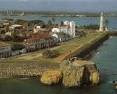
Jaffna or Yazhpanam (Tamil: யாழ்ப்பாணம், Sinhala: යාපනය) (யாழ் meaning = Harp and பாணம் meaning = Town, therefore யாழ்ப்பாணம் means Town of (the) Harper) is the capital city of the Northern Province, Sri Lanka. Though most of the residents of Jaffna are Sri Lankan Tamils, there is also a minor presence of Sri Lankan Moors (Muslims) and Portuguese Burghers (Roman Catholics). Almost all Sri Lankan Muslims were driven off from Jaffna by the LTTE in the 1990s, as a result of the ethnic conflict which started in the 1970s [1] which today leaves Jaffna almost exclusively Tamil, apart from the military personnel.EtymologyIn the local Tamil dialect, it is currently spelt as Yaalpaanam and it is generally believed that the term Yaalpaanam is derived from Yaal and Paanam meaning land of the harp player alluding to a myth of a blind lute player receiving the land as a royal grant. Currently in Sinhalese, it is known as Yapanaya. Jaffna may also be a latter-day simplification of the name Yapa Patuna. A prominent port in the area was known as Yapa Patuna in Sinhala and Yaalpaana Pattinam in Tamil since medieval times. The ports of Jaffna were on the ancient silk route which can be traced from China via Vietnam, Cambodia, Thailand, Java and Malaya. Marco Polo vividly described the various aspects of life in Jaffna. He was travelling by the silk route by sea guarding a Chinese princess - a daughter of Kublai Khan - and a future wife of the Persian king. Jaffna was the safest route for an emperor's daughter and a future queen of Persia.[edit] History[edit] Written recordsThe Northern Sri Lanka city of Jaffna has a written history of 2000 years. Along with the Mahavamsa and Chulavamsa, The Yalpana Vaipava Malai, Kailaya Malai, and Irasamurai are some of the books containing historical facts of Jaffna. The Abitta Jataka in the Pali canon refers to the Brahmin sage Akitta (Agastya) who had visited the island of Kara adjacent to Nagadipa. This is identified by some as the present Karaitivu or Karainagar.One of the five great epics of Tamil literature Manimekalai refers to a place called Manipallavam which might well be Jaffna[1]. The archeological ruins in Kantarodai might well confirm this literary reference. Manimekalai speaks about Buddha's visit to Jaffna. The Mahavamsa also mentions that Lord Buddha used his siddhi or yogic powers to visit Jaffna by air to resolve a crisis over a jewel between the Naga chieftains and introduced Buddhism to them. It refers to the port of Jambukola Pattuna, now known as Sambalturai, where ships embarked to India. The Sangam era Tamil literature in the early centuries of the common era included poets Eelattu Poothanthevanar from Mantai in what is today the Mannar District of Sri Lanka.[edit] Jaffna Kingdom.


The Jaffna Kingdom (1215-1619; also known as the Kingdom of Aryacakravarti) began with the invasion of one Magha also called as Kulankai Chakravarti claiming to be from Kalinga in India. Some historians says the Tamil word Kulangai often misspelled as Kalinga because he had a defect in one arm,[2] which is the reason he was called Kulangai. It eventually became a tribute paying client of the Pandyan Empire in India around the 1250s only to become independent with the fragmentation of the Pandyan control. For a brief period in the early and middle fourteenth century it was an ascending power in Sri Lanka with all major kingdoms becoming its tributaries only to become occupied by the rival Kotte Kingdom in the 1450s.After it was reconstituted its rulers energies were directed towards consolidating its economic potential by maximizing revenue from pearls and elephant exports and land revenue. It was less feudalized than most of other Sri Lanka kingdoms of the same period. Important local Tamil literature was produced and Hindu temples were built during this period including an academy for language advancement.The arrival of the Portuguese colonial power in Sri Lanka in 1505 and the understanding of its strategic location in the Palk Strait connecting all interior Sinhalese kingdoms to South India created political problems. Many of its kings confronted and eventually made peace with the Portuguese colonials. Eventually Cankili II (1617-1619) a usurper to the throne confronted the Portuguese and was defeated, thus bringing the kingdom’s independent existence to an end in 1619.[edit] Portuguese colony
Main article: Portuguese CeylonAfter lasting for over 400 years,the Dravidian-influenced Jaffna Kingdom finally lost its independence to the Portuguese in 1621. The Portuguese captured the King of Jaffna Sangili Kumaran and took him to Goa in India along with his sons. After the trial, the Portuguese found him guilty of treason and hanged him along with his sons. With the Jaffna Kingdom’s demise, the only indigenous independent political entity that was not Sinhalese and Buddhist in character came to an end in the Island. The Portuguese built the Jaffna Fort and the moat around it.[edit] Dutch colony
Main article: Dutch CeylonThe Tamils and the Kandyan Kingdom collaborated and conspired with the Dutch rulers of Batavia (today's Jakarta in Indonesia). The Dutch invasion from Batavia brought religious freedom for Tamils and Muslims.The Dutch and later the colonial English ruler reigned for approximately three centuries, with each ruling for approximately 150 years. The Jaffna Tamil has several Portuguese and Dutch words still in usage.During the Dutch rule the islands of the Palk Straits were renamed after Leiden, Kayts and other cities in the Netherlands. The Dutch priest Rev Philippus Baldeus wrote a great historical record similar to Mahawamsa on the Jaffna people and their culture and it was immediately published in Dutch and German with several beautiful pictures. A granite stone inscription at the Point Pedro Market Square still marks the place where Rev Baldeus preached to the Tamils under a big tamarind tree. This tamarind tree was uprooted during the cyclone of 1963.[edit] British colony
Main article: British CeylonWith the Treaty of Amiens all maritime territory under Dutch rule became apart of the British Crown. This included the what is today, Jaffna district. In 1815, the Kandyan Kingdom was brought under British with signing of the Kandyan Convention.British rule began in 1798. Many educational institutions were established during this period. The English language was taught to the locals. The Jaffna Tamils were given higher ranks in government institutions. At this time American missionaries and Anglican missionaries were in close competition with Catholic missionaries in establishing churches and schools in every nook and corner. The Hindu Board of Education in turn established its own network of schools. Several high schools and western style education became the hallmark of Jaffna. Jaffna Tamils became loyal subjects of the ever-expanding British Empire and took the middle-level positions in public service throughout the South East Asian countries of the British Raj (Burma, Malaya, Borneo and Singapore) in the late 1800s/early 1900s.[edit] Christian missionary activity
Main articles: Jaffna Roman Catholic diocese and American Ceylon MissionJaffna also played an important role in the Roman Catholic religious administration of Sri Lanka. It also plays an important role in the administration of the Church of South India in Sri Lanka, a group of Protestant denominations.[edit] Ethnic conflict
Main articles: Ethnic conflict in Sri Lanka and Human rights in Sri LankaDue to the civil war, the city has witnessed wholesale massacres, disappearances of the civilian population and a deterioration in the human rights situation. Currently it is occupied by the Sri Lankan Army, with full government control; between 1992 and 1995 it was under the control of the LTTE before that the Indian Army IPKF had captured it first in 1989 and handed over to Sri lankan Army after a hard fought battle before its withdrawal from Sri Lanka. Due to ethnic conflict in Sri Lanka, many residents moved out of the city, and thus the population was reduced dramatically. According to the 2001 census, the population of the municipality is about 145,600[citation needed]. The population of the district is currently estimated by the district administration at 600,000. Jaffna also functions as the economic and cultural capital of Sri Lankan Tamils.Jaffna was once a stronghold of the Liberation Tigers of Tamil Eelam (LTTE), a separatist outfit that seeks to set up an independent Tamil Eelam for Tamil-speaking people in Sri Lanka. Jaffna currently is under the occupation of the government of Sri Lanka.The Jaffna Public library was burnt down by an organized mob in June 1981, when ethnic tensions in the country were building steadily towards war. The Sri Lankan government (United National Party) at that time was accused of letting the paramilitaries loose in Jaffna, following an incident where two Sinhalese policemen were killed by a Tamil group. The library was renovated in 2003 by the government of Sri Lanka.[3][edit] Mass exodus and ethnic cleansing
Main articles: Sri Lankan Tamil diaspora and Expulsion of Muslims from JaffnaMany of the Tamils from this region moved out to other parts of the island or to foreign countries. This exodus of Tamils from Jaffna occurred for a number of reasons.The entire Muslim population of Jaffna was forced to leave within 48 hours in 1990 due to an order by the LTTE allegedly to avenge the ethnic cleansing of Tamils in the East. The mass exodus of Tamils from Jaffna to Vanni is another significant incident in the history of Jaffna. When Sri Lankan Army captured Jaffna from LTTE occupaton in December 1995. Nearly 450,000 Tamils displaced during at that time.[4] There have been claims of human rights violations on both sides. Due to Jaffna becoming a constant battleground between the Sri Lankan military and the LTTE, many people have been displaced. The tight security measures loosened as the war ended.[edit] Demography
Main article: Sri Lankan Tamils85% of the population of the Jaffna and Kilinochchi districts are Hindus. The Hindus follow the Saivite tradition. The remainder are largely Roman Catholics or Protestants, some of whom are descendants of colonial settlers, known as Burghers. The Tamils are divided along caste lines, with the farmer-caste Vellalar forming the majority. However, there are many Caste divisions within the Vellalars and they vary in social status, with various Saiva Vellalars usually on top. The maritime caste known as the Karaiyar dominates the coast. The Karaiyar caste is seen as inferior due to their ancestral profession as fisherman, and due to their lower caste in terms of the ancient Hindu Varna system.Sri Lankan Tamil is the major language spoken in Jaffna by the vast majority of the population. The other language spoken is Sinhala by 1 percent of the population. English is widely spoken and understood in the cities. Tamil and Sinhala is official language of the Sri Lanka. Tamil is the official language and administrative language of the Northern Province.[edit] Culture


Nallur Kandaswamy Kovil, Jaffna.


Nallur Kandaswamy Kovil, Jaffna.Most Jaffna Tamils belong to the Dravidian culture, thus, Pongal, the Hindu New Year in April, Deepavali, Navaratri and Shivaratri are some of the religious festivals celebrated, see Culture of Sri Lanka.Arts The traditional dance of the Sri Lankan Tamils is called Kooththu. These are a variety of stage dramas. Karthavarayan Kooththu, Sangiliyan Kooththu and Poothaththambi Kooththu are some of the famous Kooththus in Jaffna. The Poothaththambi Kooththu has been staged from the Dutch era. These arts are mainly focused on the historical values of the community and to entertain the people. The villuppattu is one of the famous arts of the tamils. Oyilaattam is a notable variety of dance in the Jaffna peninsula. The South Indian dance and music is also indigenous to Jaffna. Noteworthy here would be Bharata Natyam and Carnatic music - the classical high traditions of Hinduism.Literature
Main article: Sri Lankan Tamil LiteratureA poet called Eelattu Poothanthevanar is mentioned in the ancient Tamil Sangam in Madurai. He was most probably from the North of Sri lanka. The Chief Nalliyakodan of Mantai in what is today Mannar sponsored several Sangam era poets in the Tamil land. Kumanan, another chief from Kudiramalai, also sponsored poets. However, the precise identity of Nalliyakodan and Kumanan is under doubt. This is discussed in Mudaliyar C. Rasanayagam's "Ancient Jaffna".The medieval Tamil court in Jaffna had produced some rare manuscripts on astronomy or ayurveda.


Public Library, Jaffna.Turning to modern times, Arumuga Navalar was born in Nallur in December 1822. He died in 1879. He helped develop modern Tamil prose and freed the language from what had become the stilted classicism of the past with his freer use of words. He translated the Bible into Tamil and then researched Hindu doctrine. Navalar wrote many Hindu religious books and was an outstanding orator. He was the pioneer of religious reforms in the Jaffna Hindu society. C.W Thamotheram pillai, another native of Jaffna, was one of the first two graduates in the Madras Presidency. He obtained his degree from the University of Madras in 1858 and contributed to Tamil studies. Dr. Ananda Coomaraswamy contributed extensively to the study of Indian art in its social context. He was born in 1877.Mallikai, Sudar, Samar, Siriththiran, Alai and Kathambam were some of the Tamil magazines published in the 1970s. Many of them disappeared after the ethnic tension in the late 1980s.The term Pulampeyar Ilakkiyam refers to the literature of the Tamil speaking people who migrated away from their native region. Viduthalai Ilakkiyam is the literature of various Tamil nationalist organizations.Media The first newspaper in Jaffna, Uthayatharakai (Morning Star) was published in 1841 by C.W. Thamotharampillai[5] By the 1940s, daily newspapers had already been started Eelakesari and Virakesari in 1930 and Thinakaran in 1932 and journals committed to the growth of modernistic, socially purposive literature Bharati and Marumalarchi in 1946 had also started coming out.Few newspapers are published in the province now in the principal language of Tamil. None in English and Sinhala. Before the Civil war commenced dozens of newspapers and magazines were published.[edit] EconomySea products, red onion, and tobacco are the main products in Jaffna. Prior to the civil war it was a place of many small scale industries manufacturing household items as well as packaging and food processing for export. Most industrialists have left or closed shops. The present Jaffna economy is facing setbacks because of the unstable connectivity with the south. The prices of goods in Jaffna are relatively high compared to the south. Currently the primary economic activity is trade. The foreign remittance from the Sri Lankan Tamil diaspora sustains many people.Jaffna Harbour The pending Sethusamudram Shipping Canal Project may increase the productivity of the Jaffna Harbour. Enlargement of the harbour will bring benefits to Sri Lanka. However it might damage the ecosystem of the area. The strategic advantages derive from obtaining a navigable sea route close to the coast, with a reduction in travel distance of more than 350 nautical miles (650 km) (for larger ships). The project is expected to provide a boost to the economic and industrial development of coastal Tamil Nadu in India. The project will be of particular significance to Jaffna, Kankesanthurai, Mannar, Point Pedro and Tuticorin harbour.[edit] Education
See also: List of Secondary Schools in Northern Province, List of Private Schools in Northern Province, and University of JaffnaJaffna is considered to be the most literate district in the whole of Sri Lanka[citation needed] (whose national literacy rate in 2001 was 90.7%[6]). In the early days (before 1970s') Sri Lankan universities were dominated by Jaffna students but currently their enrollment numbers are minimized due to the effects of a district based quota system introduced in the 1970s as well as the effects of the civil war. However, in 1974 the government opened the University of Jaffna which is de facto reserved for students from the region, while they have a quota based access to the other Sri Lankan universities as well.Peter Percival was a Wesleyan Missionary who started several schools in Jaffna including Jaffna Central College, Hartley College, Vembadi Girls School, and the Methodist Girls High School. The first translation of the Bible into Tamil was carried out by Fr Peter Percival and Arumuka Navalar.[citation needed]The Jaffna Hindu College is one of the leading schools in Jaffna. This institution was established by a Hindu asscociation in 1890. The Hindu Board of Education established a network of grant-in-aid schools. Sir Ponnambalam Ramanathan established Ramanathan College for Girls and Parameshwarar College for Boys.Founded by American missionaries in 1819, Jaffna College has records of Malaysia, Singaporean, South Indian and even Japanese students enrollment in the 1930s and 1940s. American missionaries also founded many other institutions of higher learning that are still functioning today.[citation needed] Today most students are locals.Jaffna is now considered a backward district for university admission by the University Grants Commission. While district quotas once kept down Jaffna numbers at the universities, today they are increased by the same quotas because of poor performance from Jaffna. Peter Percival arrived in Ceylon in 1926 after Central College was founded. He reorganized the school in 1936 or so.Contributions by Jaffna Tamils The first full translation of the Bible was in Tranquebar in 1723 succeeding partial versions earlier. This Tamil Bible was translated by Bartholomäus Ziegenbalg and Benjamin Schultze. The translation of Fabricius followed—the New Testament in 1772 and Old Testment in 1791. The Jaffna version was by a six member committee, headed by Peter Percival, Principal of Central School. Jaffna at that time had a tremendous fund of scholarship from which to draw, both on the side of Western missionaries as well as on that of Jaffna Tamils. The other missionaries were Levi Spaulding, H. R. Hoisington, Samuel Hutchings, Daniel Poor and Miron Winslow. They knew Hebrew and Greek to translate. Arumuka Navalar was merely one of at least 2 Pandit Assistants who simply put the missionary translation into good Tamil—interestingly a form of Tamil that was soon rejected in Jaffna itself and a new translation modelled on the Tamil of Fabricius is what we use today in Indian and Sri Lankan Churches. Navlar had very limited eudcation and could not be credited with the scholarship and methodology required for serious translation. As the front page of the 1850 Bible says, "Translated out of the original tongues and with former translations diligently compared and revised." Thus the translators themselves do not claim to have made the first translation and this claim comes only from sectarian groups in Jaffna. The Americans founded only one institution of higher learning—Batticotta Seminary

Kataragama Temple

Today it is a fast developing township surrounded by jungle in the deep south of Sri Lanka. But in medieval times it was only a small village. It is situated 228km ESE of Colombo, the capital of Sri Lanka.
Kataragama also Katharagama,and Katirkamam (Tamil கதிர்காமம்) is a regionally popular place of pilgrimage of Hindu, Buddhist, Muslim and indigenous Vedda communities of Sri Lanka and South India, where the god Muruga is the main deity
Hindu Katirkamam .
Main article: Katirkamam (Hindu temple)Tamil Hindus of Sri Lanka and South India refer to the place as Katirkamam and it has a famous Hindu shrine dedicated to Lord Katirkaman. The presiding Deity is Lord Murugan or Skanda. Saivite Hindus of South India call him also as Subrahmanya. Following are the other names to identify the same God in the Hindu texts; Kandasamy, Katiradeva, Katiravel, Kartikeya, and Tarakajith. Some of these names are derived from the root Katir from Katirkamam. "Katir" means formless light.The Deity is depicted either with six faces and twelve hands, or one face and four hands. Out of love for Lord Murugan and to mitigate bad karma, bhaktars pierce their cheeks and tongues with vels, pull large chariots carrying murthi of Murugan with large hooks that have been pierced through the skin of their backs. This practice is known as kavadi. Murugan's vahana or vehicle is Mayil, the peacock. There is also a related shrine called as Sella Katirkamam dedicated to the beloved elephant-faced God Ganesha nearby, who is known as Lord Murugan's elder brother.The local river namely Manik Ganga or Manika Gangai (River of Gems) functions as a place of ablution where a sacred bath is taken to purify oneself. Local residents declare that one can be healed of ailments by bathing in it not only from its high gem content but also the medicinal properties of the roots of various trees that line the river through the jungle.[edit] Buddhist Kataragama[hide]
Part of a series on
Buddhism


Portal of Buddhism
Outline of BuddhismHistory of Buddhism
Timeline - Buddhist councils
Major figures
Gautama Buddha
Disciples · Later BuddhistsDharma or concepts
Four Noble Truths
Noble Eightfold Path
Three marks of existence
Dependent origination
Saṃsāra · Nirvāṇa
Skandha · Cosmology
Karma · RebirthPractices and attainment
Buddhahood · Bodhisattva
4 stages of enlightenment
Wisdom · Meditation
Smarana · Precepts · Pāramitās
Three Jewels · Monastics
LaityCountries and regions
Schools
Theravāda · Mahāyāna
VajrayānaTexts
Chinese canon · Pali canon
Tibetan canonRelated topics
Comparative studies
Cultural elements

This box: view • talk • editKataragama is one of the 16 principal places of Buddhist pilgrimage to be visited in Sri Lanka. According to the chronicle of Sri Lankan history the Mahawamsa, when the Bo-sapling or Pipil tree sapling under which Gotama Buddha attained enlightenment in North India was brought to the city of Anuradhapura 2,300 years ago, the warriors or Kshatriyas from Kataragama were present on the occasion to pay homage and respect.

Kiri Vehera at NightThe Buddhist Kiri Vehera Dagoba which stands in close proximity to the Hindu temple was built by the King Mahasena. According to the legend, Lord Buddha, on his third and the last visit to Sri Lanka, was believed to have met the King Mahasena who ruled over the Kataragama area in 580 BC. Thus the local Sinhalese Buddhists believe that Kataragama was sanctified by Lord Buddha. The King met the Lord Buddha and listened to the Buddha's discourse and as a token of gratitude, the Dagoba was built on that exact spot where it now stands.[edit] Pre Hindu and Buddhist originsThe deity at Kataragama is indigenous and long-celebrated in Sri Lankan lore and legend, and originally resides on the top of mountain called Wædahiti Kanda (or hill of the indigenous Vedda people) just outside of the Kataragama town. Since ancient times an inseparable connection between the God and his domain has existed. At one time the local deity was identified with God Saman , a deity that was important to the Sinhalese people before their conversion to Buddhism.As was the Sinhalese tradition, local ancestors, rulers and kings were ordained as deities. God Saman also became a god in that way. Therefore it is also believed that King Mahasena came to be worshiped as God Katharagama.Till today the indigenous Vedda people come to venerate at the temple complex from their forest abodes. As a link to the Vedda past the temple holds its annual festival, that celebrates the God's courtship and marriage to a Vedda princess, in July to August.Secretive shrines outside the main temple complex are also used in sorcery and cursing by local Sinhalese. [1][edit] Temple of SyncretismKataragama is a multi-religious sacred city as it contains an Islamic Mosque within its temple complex as well.In spite of the differences of caste and creed, many Sri Lankans show great reverence to God Kataragama. They honor him as a very powerful deity and beg divine help to overcome their personal problems or for success in business enterprises etc., with the fervent hope that their requests would be granted. They believe that God Kataragama actually exists and is vested with extraordinary power to assist those who ever appeal to him with faith and devotion in times of their distress or calamity. Many Tamils from other areas of Sri Lanka visit Kataragama.[edit] TransportIn 1992, it was proposed to extend the railway from Matara to Kataragama and beyond. The Kataragama railway extension is currently being constructed under a three phase accelerated development program. The first phase of the construction has already begun and will consist of the 27 km stretch from Matara to Beliatta costing 60 Million rupees; construction has already commenced on the bridge over the Nilwala River by the State Engineering Corporation. The entire project is expected to take six years to complete and will cost around three billion rupees.

Wednesday, December 30, 2009

Singapore, officially the Republic of Singapore, is an island city-state off the southern tip of the Malay Peninsula, 137 kilometres (85 mi) north of the equator, south of the Malaysian state of Johor and north of Indonesia's Riau Islands. At 710.2 km2 (274.2 sq mi), Singapore is a microstate and the smallest nation in Southeast Asia. It is substantially larger than Monaco and Vatican City, the only other surviving sovereign city-states.
Before European settlement, the island now known as Singapore was the site of a Malay fishing village at the mouth of the Singapore River. Several hundred indigenous Orang Laut people also lived along the nearby coast, rivers and on smaller islands. In 1819, the British East India Company, led by Sir Stamford Raffles, established a trading post on the island, which was used as a port along the spice route. Singapore became one of the most important commercial and military centres of the British Empire, and the hub of British power in Southeast Asia.
During the Second World War, the British colony was occupied by the Japanese after the Battle of Singapore, which Winston Churchill called "Britain's greatest defeat". Singapore reverted to British rule in 1945, immediately after the war. Eighteen years later, in 1963, the city, having achieved independence from Britain, merged with Malaya, Sabah, and Sarawak to form Malaysia. However, Singapore's merger proved unsuccessful, and, less than two years later, it seceded from the federation and became an independent republic within the Commonwealth of Nations on 9 August 1965. Singapore was admitted to the United Nations on 21 September of that year.
Since independence, Singapore's standard of living has risen dramatically. Foreign direct investment and a state-led drive to industrialization based on plans drawn up by the Dutch economist Albert Winsemius have created a modern economy focused on industry, education and urban planning. Singapore is the 5th wealthiest country in the world in terms of GDP (PPP) per capita. As of January 2009, Singapore's official reserves stand at US$170.3 billion.
In 2009, the Economist Intelligence Unit ranked Singapore the tenth most expensive city in the world in which to live—the third in Asia, after Tokyo and Osaka.[13] The 2009 Cost of Living survey, by consultancy firm Mercer, has ranked Singapore similarly as the tenth most expensive city for expatriates to live in.
The population of Singapore including non-residents is approximately 4.99 million. Singapore is highly cosmopolitan and diverse with Chinese people forming an ethnic majority with large populations of Malay, Indian and other people. English, Malay, Tamil, and Chinese are the official languages.
Singapore is a parliamentary republic, and the Constitution of Singapore establishes representative democracy as the nation's political system. The People's Action Party (PAP) dominates the political process and has won control of Parliament in every election since self-government in 1959.
Etymology

The English language name Singapore comes from Malay Singapura, "Lion-city", but it is possible that one element of its name had a more distant original source. Pura comes from Sanskrit puram, "city, fortress", and is related to Greek polis, "citadel, city". Singa- comes from Sanskrit siṃha, which means lion. Today the city-state is referred to as the Lion City. Studies of Singapore indicate that lions probably never lived there, not even Asiatic lions; the beast seen by Sang Nila Utama, the founder of Singapore who gave it the name meaning "Lion City", was most likely a tiger, probably the Malayan Tiger. Alternatively, it could simply be a reference to the ancient Sinhapura as described in the Mahabharata.

Government and politics
Parliament House

Singapore is a parliamentary democracy with a Westminster system of unicameral parliamentary government representing different constituencies. The bulk of the executive powers rests with the Cabinet, headed by the Prime Minister, currently Mr Lee Hsien Loong. The office of President of Singapore, historically a ceremonial one, was granted some veto powers as of 1991 for a few key decisions such as the use of the national reserves and the appointment of judiciary positions. Although the position is to be elected by popular vote, only the 1993 election has been contested to date. The legislative branch of government is the Parliament
Parliamentary elections in Singapore are plurality-based for group representation constituencies since the Parliamentary Elections Act was modified in 1991.
The Members of Parliament (MPs) consist of either elected, non-constituency or nominated Members. The majority of the Members of Parliament are elected into Parliament at a General Election on a first-past-the-post basis and represent either Single Member or Group Representation Constituencies (GRCs
The elected Members of Parliament act as a bridge between the community and the Government by ensuring that the concerns of their constituents are heard in the Parliament. The present Parliament has 94 Members of Parliament consisting of 84 elected Members of Parliament, one NCMP and nine Nominated members of Parliament.
The People's Action Party (PAP) has been the ruling party in Singapore since self-government was attained. There are several opposition parties in Singapore, the most notable being the Workers' Party of Singapore, the Singapore Democratic Party (SDP) and the Singapore Democratic Alliance (SDA). The Economist Intelligence Unit describes Singapore as a "hybrid regime" of democratic and authoritarian elements. Freedom House ranks the country as "partly free". Although general elections are free from irregularities and vote rigging, the PAP has been criticized by some for manipulating the political system through its use of censorship, gerrymandering, and civil libel suits against opposition politicians.
Singapore has a successful and transparent market economy. Government-linked companies are dominant in various sectors of the local economy, such as media, utilities, and public transport. Singapore has consistently been rated as the least corrupt country in Asia and among the world's ten most free from corruption by Transparency International.
Although Singapore's laws are inherited from English and British Indian laws, and includes many elements of English common law, the government has also chosen not to follow some elements of liberal democratic values. There are no jury trials and there are laws restricting the freedom of speech that may breed ill will or cause disharmony within Singapore's multiracial, multi-religious society. Criminal activity is often punished with heavy penalties including heavy fines or corporal punishment (caning). The Singapore government argues that Singapore has the sovereign right to determine its own judicial system and impose what it sees as an appropriate punishment, including capital punishment (hanging) for first-degree murder and drug trafficking.


Geography and climate

Singapore Downtown as seen from the DHL Balloon
A Housing Development Board estate in Toa Payoh

Singapore Botanic Gardens, a 67.3-hectare (166 acre) Botanic Gardens in Singapore that includes the National Orchid Garden, which has a collection of more than 3,000 species of orchids
Singapore consists of 63 islands, including mainland Singapore. There are two man-made connections to Johor, Malaysia — Johor-Singapore Causeway in the north, and Tuas Second Link in the west. Jurong Island, Pulau Tekong, Pulau Ubin and Sentosa are the largest of Singapore's many smaller islands. The highest natural point of Singapore is Bukit Timah Hill at 166 m (Template:Convert/Ft). The south of Singapore, around the mouth of the Singapore River and what is now the Downtown Core, used to be the only concentrated urban area, while the rest of the land was either undeveloped tropical rainforest or used for agriculture. Since the 1960s, the government has constructed new residential towns in outlying areas, resulting in an entirely built-up urban landscape. The Urban Redevelopment Authority was established on 1 April 1974, responsible for urban planning.
Singapore has on-going land reclamation projects with earth obtained from its own hills, the seabed, and neighbouring countries. As a result, Singapore's land area grew from 581.5 km2 (224.5 sq mi) in the 1960s to 704 km2 (271.8 sq mi) today, and may grow by another 100 km² (38.6 sq mi) by 2030. The projects sometimes involve some of the smaller islands being merged together through land reclamation in order to form larger, more functional islands, such as in the case of Jurong Island.
Under the Köppen climate classification system, Singapore has a tropical rainforest climate with no distinctive seasons. Its climate is characterized by uniform temperature and pressure, high humidity, and abundant rainfall. Temperatures range from 22 °C to 34 °C (72° to 93 °F). On average, the relative humidity is around 90% in the morning and 60% in the afternoon. During prolonged heavy rain, relative humidity often reaches 100%. The lowest and highest temperatures recorded in its maritime history are 19.4 °C (66.9 °F) and 35.8 °C (96.4 °F) respectively. June and July are the hottest months, while November and December make up the wetter monsoon season. From August to October, there is often haze, sometimes severe enough to prompt public health warnings, due to bush fires in neighbouring Indonesia. Singapore does not observe daylight saving time or a summer time zone change. The length of the day is nearly constant year round due to the country's location near the equator.
About 23% of Singapore's land area consists of forest and nature reserves. Urbanisation has eliminated many areas of former primary rainforest, with the only remaining area of primary rainforest being Bukit Timah Nature Reserve. A variety of parks are maintained with human intervention, such as the Singapore Botanic Gardens.


The History of London

History

Toponomy

Wide river flanked by tall buildings on either side. There are a number of small boats and one large battleship in the centre of the river. The rooftop dome of St Paul's Cathedral is visible in the skyline to the right
The name London may derive from the River Thames

The etymology of London is uncertain. It is an ancient name and can be found in sources from the 2nd century. It is recorded c. 121 as Londinium, which points to Romano-British origin. The earliest attempted explanation, now disregarded, is attributed to Geoffrey of Monmouth in Historia Regum Britanniae. The name is described as originating from King Lud, who had allegedly taken over the city and named it Kaerlud.

From 1899 it was commonly accepted that the name was of Celtic origin and meant place belonging to a man called *Londinos; this explanation has since been rejected. Richard Coates put forward an explanation in 1998 that it is derived from the pre-Celtic Old European *(p)lowonida, meaning 'river too wide to ford', and suggested that this was a name given to the part of the River Thames which flows through London; from this, the settlement gained the Celtic form of its name, *Lowonidonjon. Until 1889 the name officially only applied to the City of London, however since then it has also referred to the County of London and now Greater London.

Prehistory and antiquity

By 1300 the City is still confined within the walls

Although there is evidence of scattered Brythonic settlements in the area, the first major settlement was founded by the Romans in 43 AD. This lasted for just seventeen years and around 61, the Iceni tribe led by Queen Boudica stormed it, burning it to the ground. The next, heavily planned incarnation of the city prospered and superseded Colchester as the capital of the Roman province of Britannia in 100. At its height during the 2nd century, Roman London had a population of around 60,000. By the seventh century, the Anglo-Saxons had created a new settlement called Lundenwic approximately 1,000 yards (910 m) upstream from the old Roman city, around what is now Covent Garden.

It is likely that there was a harbour at the mouth of the River Fleet for fishing and trading, and this trading grew until the city was overcome by the Vikings and forced to relocate the east, back to the location of the Roman Londinium, in order to use its walls for protection. Viking attacks continued to increase, until 886 when Alfred the Great recaptured London and made peace with the Danish leader, Guthrum. The original Saxon city of Lundenwic became Ealdwic ("old city"), a name surviving to the present day as Aldwych, which is in the modern City of Westminster.

Middle Ages

Westminster Abbey is one of London's oldest and most important buildings and a World Heritage Site

Canute took control of the English throne in 1016, controlling the city and country until 1035, when his death resulted in a reversion to Saxon control under his pious stepson Edward the Confessor, who re-founded Westminster Abbey and the adjacent Palace of Westminster.[32] By this time, London had become the largest and most prosperous city in England, although the official seat of government was still at Winchester. Following a victory at the Battle of Hastings, William the Conqueror, the then Duke of Normandy, was crowned King of England in the newly finished Westminster Abbey on Christmas Day 1066. William granted the citizens of London special privileges, while building what is now known as the Tower of London, in the south-east corner of the city, to keep them under control.

In 1097, William II began the building of Westminster Hall, close by the abbey of the same name. The hall became the basis of a new Palace of Westminster, the prime royal residence throughout the Middle Ages. Westminster became the seat of the royal court and government, while its distinct neighbour, the City of London, was a centre of trade and commerce and flourished under its own unique administration, the Corporation of London. In 1100 its population was around 18,000; by 1300 it had grown to nearly 100,000.

There was an increasing population of Jews, until the edict of King Edward I in 1290, expelled them from England. Disaster struck during the Black Death in the mid-14th century, when London lost nearly a third of its population. Apart from the invasion during the Peasants' Revolt in 1381 London remained relatively untouched by the various civil wars during the Middle Ages.

Early modern

The Great Fire of London destroyed many parts of the city in 1666

During the Tudor period the Reformation produced a gradual shift to Protestantism, with much of London passing from church to private ownership. Mercantilism grew and monopoly trading companies such as the British East India Company were established, with trade expanding to the New World. London became the principal North Sea port, with migrants arriving from England and abroad. The population rose from an estimated 50,000 in 1530 to about 225,000 in 1605.

In the 16th century William Shakespeare and his contemporaries lived in London at a time of hostility to the development of the theatre. By the end of the Tudor period in 1603, London was still very compact. There was an assassination attempt on James I in Westminster, through the Gunpowder Plot on 5 November 1605. London was plagued by disease in the early 17th century, culminating in the Great Plague of 1665–1666, which killed up to 100,000 people or a fifth of the population.

The Great Fire of London broke out in City and quickly swept through the wooden buildings. Rebuilding took over ten years and was supervised by Robert Hooke as Surveyor of London. In 1708 Christopher Wren's masterpiece, St. Paul's Cathedral was completed. During the Georgian era new districts such as Mayfair were formed in the west; and new bridges over the Thames encouraged the development in South London. In the east, the Port of London expanded downstream.

In 1762 George III acquired Buckingham House and it was enlarged over the next 75 years. During the 18th century, London was dogged by crime and the Bow Street Runners were established in 1750 as a professional police force. The coffee house became a popular place to debate ideas, with growing literacy and the development of the printing press making news widely available; and Fleet Street became the centre of the British press.

“You find no man, at all intellectual, who is willing to leave London. No, Sir, when a man is tired of London, he is tired of life; for there is in London all that life can afford.”

—Samuel Johnson[51]

Late modern and contemporary

A London street hit during the Blitz of World War II

London was the world's largest city from about 1831 to 1925. Rising traffic congestion led to the creation of the world's first local urban rail network. The Metropolitan Board of Works oversaw infrastructure expansion. It was replaced in 1889 by the London County Council, London's first elected city-wide administration. The Blitz and other bombing by the German Luftwaffe during World War II killed over 30,000 Londoners and destroyed large tracts of housing and other buildings across London. Immediately after the war, the 1948 Summer Olympics were held at the original Wembley Stadium, at a time when the city had barely recovered from the war.

In 1951 the Festival of Britain was held on the South Bank. The Great Smog of 1952 led to the Clean Air Act 1956, which ended the "pea-souper" fogs for which London had been notorious. From the 1950s onwards, London became home to a large number of immigrants, largely from Commonwealth countries such as Jamaica, India, Bangladesh and Pakistan, making London one of the most diverse cities in Europe.

Starting in the mid-1960s, London became a centre for the worldwide youth culture, exemplified by the Swinging London subculture associated with Carnaby Street. The role of trendsetter was revived during the Punk era. In 1965 London's political boundaries were expanded to take into account the growth of the urban area and a new Greater London Council was created. During The Troubles in Northern Ireland, London was subjected to terrorist attacks by the Provisional IRA. Racial inequality was highlighted by the 1981 Brixton riot. Greater London's population declined steadily in the decades after World War II, from an estimated peak of 8.6 million in 1939 to around 6.8 million in the 1980s. The principal ports for London moved downstream to Felixstowe and Tilbury, with the London Docklands area becoming a focus for regeneration.

The Thames Barrier was completed in the 1980s to protect London against tidal surges from the North Sea. The Greater London Council was abolished in 1986, which left London as the only large metropolis in the world without a central administration. In 2000, London-wide government was restored, with the creation of the Greater London Authority. To celebrate the start of the 21st century, the Millennium Dome and London Eye were constructed. On 7 July 2005, several London Underground trains and a bus were bombed in a series of terrorist attacks.

The city of LONDON


London (pronounced /ˈlʌndən/) is the capital of England and the United Kingdom. A major settlement for two millennia, its history goes back to its founding by the Romans, who called it Londinium. London's core, the ancient City of London, the 'square mile', retains its mediaeval boundaries. Since at least the nineteenth century, the name "London" has also referred to the metropolis developed around it. Today, the bulk of this conurbation forms the London region and the Greater London administrative area, with its own elected mayor and assembly.


London is a leading global city and one of the world's largest financial centres with the largest city GDP in Europe. Central London is home to the headquarters of most of the UK's top 100 listed companies (the FTSE 100) and more than 100 of Europe's 500 largest. London's influence in politics, finance, education, entertainment, media, fashion, the arts and culture in general contributes to its global position. It is a major tourist destination for both domestic and overseas visitors. London hosted the 1908 and 1948 Summer Olympics and will host the 2012 Summer Olympics. London contains four World Heritage Sites: the Tower of London; the historic settlement of Greenwich; the Royal Botanic Gardens, Kew; and the site comprising the Palace of Westminster, Westminster Abbey and St. Margaret's Church.


London has a diverse range of peoples, cultures, and religions, and more than 300 languages are spoken within its boundaries. In July 2007 it had an official population of 7,556,900 within the boundaries of Greater London, making it the most populous municipality in the European Union.[20] The Greater London Urban Area (the second largest in the EU) has a population of 8,278,251. while the metropolitan area (the largest in the EU) has an estimated total population of between 12 million and 14 million. The London Underground network, administered by Transport for London, is the most extensive underground railway network in the world, London Heathrow Airport is the world's busiest airport by number of international passengers and the airspace is the busiest of any urban centre in the world.


Governance

Local government

The Greater London Authority is based in City Hall, Southwark

The administration of London is formed of two tiers—a city-wide, strategic tier and a local tier. City-wide administration is coordinated by the Greater London Authority (GLA), while local administration is carried out by 33 smaller authorities.[54] The GLA consists of two elected components; the Mayor of London, who has executive powers, and the London Assembly, who scrutinise the mayor's decisions and can accept or reject his budget proposals each year.

The headquarters of the GLA is City Hall, Southwark; the current mayor is Boris Johnson. The mayor's statutory planning strategy is published as the London Plan, which as of mid-2009 is being revised, for final publication in 2011. The local authorities are the councils of the 32 London boroughs and the City of London Corporation.[55] They are responsible for most local services, such as local planning, schools, social services, local roads and refuse collection. Certain functions, such as waste management, a provided through joint arrangements.

Policing in Greater London, with the exception of the City of London, is provided by the Metropolitan Police Service, overseen by the Metropolitan Police Authority. The City of London has its own police force – the City of London Police. The British Transport Police are responsible for police services on National Rail and London Underground services in the capital.

The London Fire Brigade is the statutory fire and rescue service for Greater London. It is run by the London Fire and Emergency Planning Authority and is the third-largest fire service in the world.[58] National Health Service ambulance services are provided by the London Ambulance Service NHS Trust, the largest free at the point of use emergency ambulance service in the world. Her Majesty's Coastguard and the Royal National Lifeboat Institution operate on the River Thames.

National government

London is an important city because the Government of the United Kingdom is located around the Palace of Westminster. Many government departments are located close to Parliament, particularly along Whitehall, including the Prime Minister's residence at 10 Downing Street.[62] The British Parliament is often referred to as the "Mother of Parliaments" (although this sobriquet was first applied to England itself by John Bright)[63] because it has been the model for most other parliamentary systems, and its Acts have created many other parliaments.

Geography

Scope

Map of Central London

Greater London is the top-level administrative subdivision covering London. The small, ancient City of London at its core once contained the whole settlement, but as the urban area grew the City Corporation resisted attempts to amalgamate it with its suburbs, causing "London" to be defined in a number ways for different purposes; and the situation was once open to legal debate. Forty percent of Greater London is covered by the London postal district, within which 'LONDON' forms part of postal addresses.

The London telephone area code covers a larger area, similar in size to Greater London, although some outer districts are omitted and some places just outside are included. The area within the orbital M25 motorway is sometimes used to define the "London area" and the Greater London boundary has been aligned to it in places.

Outward urban expansion is now prevented by a metropolitan green belt, although the built-up area extends beyond the boundary in places, resulting in a separately-defined Greater London Urban Area. Beyond this is the vast London commuter belt. Greater London is split for some purposes into Inner London and Outer London. The city is split by the River Thames into North and South, with an informal Central London area in its interior. The coordinates of the nominal centre of London, traditionally considered to be the original Eleanor Cross at Charing Cross near the junction of Trafalgar Square and Whitehall, are approximately 51°30′29″N 00°07′29″W / 51.50806°N 0.12472°W / 51.50806; -0.12472.

Status

Within London, both the City of London and the City of Westminster have City status and both the City of London and the remainder of Greater London are the ceremonial counties.[73] The current area of Greater London has incorporated areas that were once part of the counties of Middlesex, Kent, Surrey, Essex and Hertfordshire. London's status as the capital of the England, and later the United Kingdom, has never been granted or confirmed officially—by statute or in written form.

Its position was formed through constitutional convention, making its status as de facto capital a part of the UK's unwritten constitution. The capital of England was moved to London from Winchester as the Palace of Westminster developed in the 12th and 13th centuries to become the permanent location of the royal court, and thus the political capital of the nation.[75] More recently, Greater London has been defined as a region of England and in this context known as London.

Topography

West and central London seen from SPOT satellite

Greater London covers an area of 607 square miles (1,570 km2). Its primary geographical feature is the Thames, a navigable river which crosses the city from the south-west to the east. The Thames Valley is a floodplain surrounded by gently rolling hills including Parliament Hill, Addington Hills, and Primrose Hill. The Thames was once a much broader, shallower river with extensive marshlands; at high tide, its shores reached five times their present width.

Since the Victorian era it has been extensively embanked, and many of its London tributaries now flow underground. The Thames is a tidal river, and London is vulnerable to flooding. The threat has increased over time due to a slow but continuous rise in high water level by the slow 'tilting' of Britain (up in the north and down in the south) caused by post-glacial rebound.

In 1974, a decade of work began on the construction of the Thames Barrier across the Thames at Woolwich to deal with this threat. While the barrier is expected to function as designed until roughly 2070, concepts for its future enlargement or redesign are already being discussed.

Climate

London has a temperate marine climate (Koppen climate classification Cfb), like much of the British Isles, so the city rarely sees extremely high or low temperatures. Summers are warm with average high temperatures of 21 °C (70 °F) – 24 °C (75 °F) and lows of 11 °C (52 °F) – 14 °C (57 °F). But temperatures can exceed 25 °C (77 °F) on many days, and in almost every year they exceed 30 °C (86 °F) on some days. The highest temperature ever recorded was 39 °C (102 °F) on 10 August 2003.

Winters in London are chilly, but rarely below freezing with daytime highs around 8 °C (46 °F) – 12 °C (54 °F), while spring has mild days and cool evenings. The lowest ever recorded temperature in recent years was −10 °C (14.0 °F) on 10 January 1982. Autumn is usually mild but often unsettled as colder air from the north and warmer air from the south meet. London is a relatively dry city with regular but generally light precipitation throughout the year, with an average of 583.6 millimetres (22.98 in) every year.

Snow is relatively uncommon, particularly because heat from the urban area can make London up to 5 °C (9 °F) warmer than the surrounding areas in winter. Some snowfall, however, is usually seen up to a few times a year. The snowfall of February 2009 was the heaviest London had seen for 18 years.

[hide]Weather data for London
MonthJanFebMarAprMayJunJulAugSepOctNovDecYear
Record high °C (°F)15
(59)
16
(61)
21
(70)
26
(79)
30
(86)
33
(91)
37
(99)
39
(102)
30
(86)
26
(79)
19
(66)
15
(59)
39
(102)
Average high °C (°F)8
(46)
8
(47)
11
(52)
13
(56)
17
(63)
20
(68)
23
(73)
23
(73)
19
(67)
15
(59)
11
(52)
9
(48)
16
(60)
Average low °C (°F)2
(36)
2
(36)
4
(39)
5
(41)
8
(46)
11
(52)
14
(57)
13
(55)
11
(52)
8
(46)
5
(41)
3
(37)
8
(46)
Record low °C (°F)-10
(14)
-9
(16)
-8
(18)
-2
(28)
-1
(30)
5
(41)
7
(45)
6
(43)
3
(37)
-4
(25)
-5
(23)
-7
(19)
-10
(14)
Precipitation mm (inches)52
(2.05)
34
(1.34)
42
(1.65)
45
(1.77)
47
(1.85)
53
(2.09)
38
(1.5)
47
(1.85)
57
(2.24)
61
(2.4)
52
(2.05)
54
(2.13)
582
(22.91)
Sunshine hours62571241501862101861861509360311,495
Avg. precipitation days171315141412111212141615165
Source: Average high, low and precipitation from the Weather Channel [82] 2009-11-29
Source #2: Record high and low are unsourced failed source verification on 2009-11-29 – may be vandalised

London is in USDA Hardiness zone 9, and AHS Heat Zone 2. Although extreme weather does not happen very often, deep depressions have been known to pass through like the Great Storm of 1987. Tornados are rare, but the Kensal Green area of the city was hit by the 2006 London tornado causing £10 million of damage and injuring 6 people. In the second half of the 19th century and the first half of the 20th, London was noted for its dense fogs and smogs. Following the deadly Great Smog of 1952, the Clean Air Act 1956 was passed, leading to the decline of such severe pollution in the capital.

Districts

The City of London and the 32 London boroughs
  1. City of London
  2. City of Westminster
  3. Kensington and Chelsea
  4. Hammersmith and Fulham
  5. Wandsworth
  6. Lambeth
  7. Southwark
  8. Tower Hamlets
  9. Hackney
  10. Islington
  11. Camden
  12. Brent
  13. Ealing
  14. Hounslow
  15. Richmond
  16. Kingston
  17. Merton
City of LondonCity of WestminsterKensington and ChelseaHammersmith and FulhamWandsworthLambethSouthwarkTower HamletsHackneyIslingtonCamdenBrentEalingHounslowRichmond upon ThamesKingstonMertonSuttonCroydonBromleyLewishamGreenwichBexleyHaveringBarking and DagenhamRedbridgeNewhamWaltham ForestHaringeyEnfieldBarnetHarrowHillingdonLondon-boroughs.svg
About this image
  1. Sutton
  2. Croydon
  3. Bromley
  4. Lewisham
  5. Greenwich
  6. Bexley
  7. Havering
  8. Barking and Dagenham
  9. Redbridge
  10. Newham
  11. Waltham Forest
  12. Haringey
  13. Enfield
  14. Barnet
  15. Harrow
  16. Hillingdon

London's vast urban area is often described using a set of district names, such as Bloomsbury, Mayfair, Wembley and Whitechapel. These are either informal designations, reflect the names of villages that have been absorbed by sprawl, or are superseded administrative units such as parishes or former boroughs.

Such names have remained in use through tradition, each referring to a local area with its own distinctive character, but without current official boundaries. Since 1965 Greater London has been divided into 32 London boroughs in addition to the ancient City of London. he City of London is the main financial district and Canary Wharf has recently developed into a new financial and commercial hub, in the Docklands to the east.

The West End is London's main entertainment and shopping district, attracting tourists.[88] West London includes expensive residential areas where properties can sell for tens of millions of pounds. The average price for properties in Kensington and Chelsea is £894,000 with similar average outlay in most of Central London.

The East End is the area closest to the original Port of London, known for its high immigrant population, as well as for being one of the poorest areas in London. The surrounding East London area saw much of London's early industrial development; now, brownfield sites throughout the area are being redeveloped as part of the Thames Gateway including the London Riverside and Lower Lea Valley, which is being developed into the Olympic Park for the 2012 Olympics.[91]

Architecture

Piccadilly Circus is a main road junction in the West End

London's buildings are too diverse to be characterised by any particular architectural style, having been built over a long period of time. Notable recent buildings are the 1980s skyscraper Tower 42, the Lloyd's building with services running along the outside of the structure, and the 2004 Swiss Re building, known as the "Gherkin". London's generally low-rise nature makes these skyscrapers and others such as One Canada Square and its neighbours at Canary Wharf and the BT Tower in Fitzrovia very noticeable from a distance.

High-rise development is restricted at certain sites if it would obstruct protected views of St. Paul's Cathedral. Nevertheless, there are plans for more skyscrapers in central London (see Tall buildings in London), including the 72-story "Shard of Glass", which will be one of the tallest buildings in Europe. Older buildings are mainly brick built, most commonly the yellow London stock brick or a warm orange-red variety, often decorated with carvings and white plaster mouldings.

Many grand houses and public buildings, such as the National Gallery, are constructed from Portland stone. Some areas of the city, particularly those just west of the centre, are characterised by white stucco or whitewashed buildings. Few structures pre-date the Great Fire of 1666, except for a few trace Roman remains, the Tower of London and a few scattered Tudor survivors in the City. Wren's late 17th century churches and the financial institutions of the 18th and 19th century such as the Royal Exchange and the Bank of England, to the early 20th century Old Bailey and the 1960s Barbican Estate form part of the varied architectural heritage.

Buckingham Palace is the official residence of the British monarch

The disused, but soon to be rejuvenated, 1939 Battersea Power Station by the river in the south-west is a local landmark, while some railway termini are excellent examples of Victorian architecture, most notably St Pancras and Paddington.[93] The density of London varies, with high employment density in the central area, high residential densities in inner London and lower densities in the suburbs.

In the dense areas, most of the concentration is achieved with medium- and high-rise buildings. London's skyscrapers such as "Gherkin", Tower 42, the Broadgate Tower and One Canada Square are usually found in the two financial districts, the City of London and Canary Wharf. Other notable modern buildings include City Hall in Southwark with its distinctive oval shape,[94] and the British Library in Somers Town/Kings Cross. What was formerly the Millennium Dome, located by the Thames to the east of Canary Wharf, is now used as an entertainment venue known as The O2.

The Monument in the City of London provides views of the surrounding area while commemorating the Great Fire of London, which originated nearby. Marble Arch and Wellington Arch, at the north and south ends of Park Lane respectively, have royal connections, as do the Albert Memorial and Royal Albert Hall in Kensington. Nelson's Column is a nationally recognised monument in Trafalgar Square, one of the focal points of the centre.

Parks and gardens

Italian gardens, Hyde Park

The largest parks in the central area of London are the Royal Parks of Hyde Park, its neighbour Kensington Gardens at the western edge of central London and Regent's Park on the northern edge. Regent's Park contains London Zoo, the world's oldest scientific zoo, and is located near the tourist attraction of Madame Tussauds Wax Museum.

Closer to central London are the smaller Royal Parks of Green Park and St. James's Park. Hyde Park in particular is popular for sports and sometimes hosts open-air concerts. A number of large parks lie outside the city centre, including the remaining Royal Parks of Greenwich Park to the sh-east and Bushy Park and Richmond Park to the south-west, as well as Victoria Park, East London to the east. Primrose Hill to the north of Regent's Park is a popular spot to view the city skyline.

Some more informal, semi-natural open spaces also exist, including the 791-acre (3.2 km2) Hampstead Heath of North London. This incorporates Kenwood House, the former stately home and a popular location in the summer months where classical musical concerts are held by the lake, attracting thousands of people every weekend to enjoy the music, scenery and fireworks.

Demography

Country of Birth[103]Population
(2001)
United Kingdom United Kingdom5,230,155
India India172,162
Republic of Ireland Republic of Ireland157,285
Bangladesh Bangladesh84,565
Jamaica Jamaica80,319
Nigeria Nigeria68,907
Pakistan Pakistan66,658
Kenya Kenya66,311
Sri Lanka Sri Lanka49,932
Ghana Ghana46,513
Cyprus Cyprus45,888
South Africa South Africa45,506
United States United States44,622
Australia Australia41,488
Germany Germany39,818
Turkey Turkey39,128
Italy Italy38,694
France France38,130
Somalia Somalia33,831
Uganda Uganda32,082
New Zealand New Zealand27,494

With increasing industrialisation, London's population grew rapidly throughout the 19th and early 20th centuries, and it was for some time in the late 19th and early 20th centuries the most populous city in the world until overtaken by New York in 1925. Its population peaked at 8,615,245 in 1939 immediately before the outbreak of World War 2. There were an estimated 7,556,900 official residents in Greater London as of mid-2007.

However, London's continuous urban area extends beyond the borders of Greater London and was home to 8,278,251 people in 2001,[2] while its wider metropolitan area has a population of between 12 and 14 million depending on the definition used.[104] According to Eurostat, London is the most populous city and metropolitan area of the European Union and the second most populous in Europe (or third if Istanbul is included). During the period 1991–2001 a net 726,000 immigrants arrived in London.

The region covers an area of 609 square miles (1,580 km2). The population density is 12,331 inhabitants per square mile (4,761 /km2), more than ten times that of any other British region. In terms of population, London is the 25th largest city and the 18th largest metropolitan region in the world. It is also ranked 4th in the world in number of billionaires (United States Dollars) residing in the city. London ranks as one of the most expensive cities in the world, alongside Tokyo and Moscow.

Ethnic groups

According to the Office for National Statistics, based on 2006 estimates, 69.4 per cent of the 7.5 million inhabitants of London were White, with 58 per cent White British, 2.5 per cent White Irish and 8.9 per cent classified as Other White. Some 13.1 per cent are of South Asian descent, with Indians making up 6.5 per cent of London's population, followed by Bangladeshis and Pakistanis at 2.3 per cent each. 2 per cent are categorised as "Other Asian".

10.7 per cent of London's population are Black, with around 5.5 per cent being Black African, 4.3 per cent as Black Caribbean and 0.7 per cent as "Other Black". 3.5 per cent of Londoners are of mixed race; 1.5 per cent are Chinese; and 1.9 per cent belong to another ethnic group.[5] As of 2008, 40% of London's total population was from an ethnic minority group.

Across London, Black and Asian children outnumber White British children by about six to four. In January 2005, a survey of London's ethnic and religious diversity claimed that there were more than 300 languages spoken and more than 50 non-indigenous communities which have a population of more than 10,000 in London. Figures from the Office for National Statistics show that, as of 2006, London's foreign-born population is 2,288,000 (31%), up from 1,630,000 in 1997.

The 2001 census showed that 27.1% of Greater London's population were born outside the UK, and a slightly higher proportion were classed as non-white. The table to the right shows the 'Country of Birth' of London residents in 2001, the date of the last UK Census. (Top 21). A portion of the German-born population are likely to be British nationals o parents serving in the British Armed Forces in Germany.

Religion

Religion in London
ReligionPercent
Christian
 
58.2%
No religion
 
15.8%
Religion not stated
 
8.7%
Islam
 
8.5%
Hinduism
 
4.1%
Judaism
 
2.1%
Sikhism
 
1.5%
Buddhists
 
0.8%
Paganism
 
0.3%
Other
 
0.2%

The majority of Londoners – 58.2% – identify themselves as Christians.[115] This is followed by those of no religion (15.8%), Muslims (8.5%), Hindus (4.1%), Jews (2.1%), Sikhs (1.5%), Buddhists (0.8%), Pagans/Wiccans (0.3%) and other (0.2%), though 8.7% of people did not answer this question in the 2001 Census.[115]

London has traditionally been dominated by Christianity, and has a large number of churches, particularly in the City of London. The well-known St Paul's Cathedral in the City and Southwark Cathedral south of the river are Anglican administrative centres, while the Archbishop of Canterbury, principal bishop of the Church of England and worldwide Anglican Communion, has his main residence at Lambeth Palace in the London Borough of Lambeth.

Important national and royal ceremonies are shared between St Paul's and Westminster Abbey. The Abbey is not to be confused with nearby Westminster Cathedral, which is the largest Roman Catholic cathedral in England and Wales.[119] Despite the prevalence of Anglican churches, observance is very low within the Anglican denomination. Church attendance continues on a long, slow, steady decline, according to Church of England statistics.

London is also home to sizeable Muslim, Hindu, Sikh, and Jewish communities. Many Muslims live in Tower Hamlets and Newham; the most important Muslim edifice is London Central Mosque on the edge of Regent's Park. Following the oil boom, increasing numbers of wealthy Middle-Eastern Muslims have based themselves around Mayfair and Knightsbridge in West London.

London's large Hindu community is found in the north-western boroughs of Harrow and Brent, the latter of which is home to one of Europe's largest Hindu temples, Neasden Temple. Sikh communities are located in East and West London, which is also home to the largest Sikh temple in the world outside India.

The majority of British Jews live in London, with significant Jewish communities in Stamford Hill, Stanmore, Golders Green, Hampstead,[126] Hendon, and Edgware in North London. Stanmore and Canons Park Synagogue has the largest membership of any single Orthodox synagogue in the whole of Europe, overtaking Ilford synagogue (also in London) in 1998. The community set up the London Jewish Forum in 2007 in response to the growing significance of devolved London Government.

Economy

The City of London is the world's largest financial centre alongside New York City[11][12][13]

London is a major centre for international business and commerce and is one of three "command centres" for the world economy, with New York City and Tokyo. According to 2005 estimates by the PricewaterhouseCoopers accounting firm, London has the 6th largest city economy in the world after Tokyo, New York City, Los Angeles, Chicago, and Paris.

London generates approximately 20% of the UK's GDP[13] (or $446 billion in 2005); while the economy of the London metropolitan area—the second largest in Europe—generates approximately 30% of the UK's GDP (or an estimated $669 billion in 2005). London is one of the pre-eminent financial centres of the world and vies with New York City as the most important location for international finance.

London's largest industry is finance, and its financial exports make it a large contributor to the UK's balance of payments. Around 325,000 people were employed in financial services in London until mid-2007. London has over 480 overseas banks, more than any other city in the world. Due to its prominent global role, London's economy has been affected by the global financial crisis of 2008–2009. The City of London estimates that 70,000 jobs in finance will be cut within a year.[135]

Canary Wharf is the home of the United Kingdom's tallest building

More than half of the UK's top 100 listed companies (the FTSE 100) and over 100 of Europe's 500 largest companies are headquartered in central London. Over 70% of the FTSE 100 are located within London's metropolitan area, and 75% of Fortune 500 companies have offices in London.[136] The City of London is home to the Bank of England, London Stock Exchange, and Lloyds of London insurance market. Along with professional services, media companies are concentrated in London and the media distribution industry is London's second most competitive sector.[137] The BBC is a significant employer, while other broadcasters also have headquarters around the city. Many national newspapers are edited in London.

Tourism is one of London's prime industries and employs the equivalent of 350,000 full-time workers in London in 2003,[138] while annual expenditure by tourists is around £15 billion.[139] A study carried out by Euromonitor in October 2007 places London at first place out of 150 of the world's most popular cities, attracting 15.6 million international tourists in 2006.[140] London attracts 27 million overnight-stay visitors every year.[141] The Port of London is the second-largest in the United Kingdom, handling 53 million tonnes of cargo each year.[142]

Transport

The London Underground, oldest and largest metro system in the world,[143] known as the The Tube, because of the shape of the tunnels

Transport is one of the four main areas of policy administered by the Mayor of London,[144] however the mayor's financial control does not extend to the longer distance rail network that enters London. In 2007 he assumed responsibility for some local lines, which now form the London Overground network, adding to the existing responsibility for the London Underground, trams and buses. The public transport network is administered by Transport for London (TfL) and is one of the most extensive in the world. Cycling is an increasingly popular way to get around London. The London Cycling Campaign lobbies for better provision.[145]

The lines that formed the London Underground, as well as trams and buses, became part of an integrated transport system in 1933 when the London Passenger Transport Board (LPTB) or London Transport was created. Transport for London (TfL), is now the statutory corporation responsible for most aspects of the transport system in Greater London, and is run by a board and a commissioner appointed by the Mayor of London.[146]

[edit] Railways

St Pancras International is served by direct high speed trains to European destinations such as Paris

The London Underground — all of which is now commonly referred to as The Tube, though originally this designation referred only to the deep-level lines, as distinct from the sub-surface lines — is one of the oldest, longest, and most expansive metro systems in the world, dating from 1863.[21][147] The system serves 270 stations[148] and was formed from several private companies, including the world's first underground electric line, the City and South London Railway.[149]

Over three million journeys a day are made on the Underground network, over 1 billion journeys each year.[150][151] An investment programme is attempting to address congestion and reliability problems, including £7 billion (€10 billion) of improvements planned for the Olympics.[152] London has been commended as the city with the best public transport.[153] The Docklands Light Railway is a second, more local metro system using smaller and lighter tram-type vehicles, which opened in 1987, serving Docklands and Greenwich.

There is an extensive above-ground suburban railway network, particularly in South London, which has fewer Underground lines. London houses Britain's busiest station - Waterloo with over 177 millon people using the interchange station each year which has services to South West London and parts of southern and western England.[154][155] Most rail lines terminate around the centre of London, running into fourteen terminal stations with the exception of the Thameslink trains connecting Bedford in the north and Brighton in the south via Luton and Gatwick Airports.[156]

Since 2007 High-speed Eurostar trains link St Pancras International with Lille, Paris, and Brussels. Journey times to Paris and Brussels of 2h 15 and 1h 51 respectively make London closer to continental Europe than the rest of Britain by virtue of the High Speed 1 rail link to the Channel Tunnel[157] while the first high speed domestic trains started in June 2009 linking Kent to London.[158]

[edit] Buses and trams

The red double-decker bus is iconic of London

London's bus network is one of the largest in the world, running 24 hours a day, with 8,000 buses, 700 bus routes, and over 6 million passenger journeys made every weekday. In 2003, the network's ridership was estimated at over 1.5 billion passenger trips per annum, more than the Underground.[159] Around £850 million is taken in revenue each year. London has the largest wheelchair accessible network in the world[160] and, from the 3rd quarter of 2007, became more accessible to hearing and visually impaired passengers as audio-visual announcements were introduced. The distinctive red double-decker buses are internationally recognised, and are a trademark of London transport along with black cabs and the Tube.[161][162]

London has a modern tram network, known as Tramlink, based around Croydon in South London. The network has 39 stops, 3 routes and carried 26.5 million people in 2008. Since June 2008 Transport for London has completely owned tramlink and plans to spend £54m until 2015 on maintenance, renewals, upgrades and capacity enhancements. Since April 2009 all trams have now been refurbished.[163]

[edit] Air

London Heathrow Airport, Terminal 5. London's Heathrow is the busiest airport in the world for international traffic, and is the major hub, British Airways[164]

London is a major international air transport hub with the largest city airspace in the world. Eight airports use the word London in their name, but most traffic passes through only five. London Heathrow Airport, in Hillingdon, West London, is the busiest airport in the world for international traffic, and is the major hub of the nation's flag carrier, British Airways.[165] In March 2008 its fifth terminal was opened,[166] and plans are already being considered for a sixth terminal[167] and third runway. Similar traffic, with the addition of some low-cost short-haul flights, is also handled at London Gatwick Airport, located south of London in West Sussex.[168]

London Stansted Airport, situated north east of London in Essex, is the main hub for Ryanair, and London Luton Airport to the north of London in Bedfordshire, caters mostly for low-cost short-haul flights.[169][170] London City Airport, the smallest and most central airport, is focused on business travellers, with a mixture of full service short-haul scheduled flights and considerable business jet traffic.[171]

[edit] Roads

Although the majority of journeys involving central London are made by public transport, car travel is common in the suburbs. The inner ring road (around the city centre), the North and South Circular roads (in the suburbs), and the outer orbital motorway (the M25, outside the built-up area) encircle the city and are intersected by a number of busy radial routes—but very few motorways penetrate into inner London. The M25 is the longest ring-road motorway in the world at 121.5 miles (195.5 km) long.[172]

A plan for a comprehensive network of motorways throughout the city (the Ringways Plan) was prepared in the 1960s but was mostly cancelled in the early 1970s. In 2003, a congestion charge was introduced to reduce traffic volumes in the city centre. With a few exceptions, motorists are required to pay £8 per day to drive within a defined zone encompassing much of congested central London.[173][174] Motorists who are residents of the defined zone can buy a vastly reduced season pass which is renewed monthly and is cheaper than a corresponding bus fare.[175] London is notorious for its traffic congestion, with the M25 motorway the busiest stretch in the country. The average speed of a car in the rush hour is 10.6 mph.[176]

Education

Home to a range of universities, colleges and schools, London has a student population of about 378,000 and is a centre of research and development. Most primary and secondary schools in London follow the same system as the rest of England—comprehensive schooling. With 125,000 students, the University of London is the largest contact teaching university in the United Kingdom and in Europe.[177] It comprises 20 colleges as well as several smaller institutes each with a high degree of autonomy.

Constituent colleges have their own admissions procedures, and are effectively universities in their own right, although most degrees are awarded by the University of London rather than the individual colleges. Its constituents include multi-disciplinary colleges such as Royal Holloway, Birkbeck, UCL,[178] King's, Goldsmiths, Queen Mary[179] and more specialised institutions such as the London School of Economics,[180] SOAS,[181] the Royal Academy of Music, London School of Hygiene & Tropical Medicine,[182] the Courtauld Institute of Art and the Institute of Education.[183]

University College London and Imperial College London have been ranked among the top ten universities in the world by Times Higher Education: in 2009 UCL was ranked the 4th best and Imperial the 5th best university in the world.[184] In addition, the London School of Economics has been described as the world‘s leading social science institution for teaching and research, and has the most international student body of any university in the world today.[185]

A number of colleges are dedicated to the fine arts, including the Royal College of Music, Royal College of Art, and Guildhall School of Music and Drama. London's other universities, such as Brunel University, City University, London Metropolitan University, Middlesex University, University of East London, University of the Arts London, University of Westminster, Kingston University and London South Bank University are not part of the University of London but are still leaders in their field and popular choices among students both nationally and internationally. Some were polytechnics until they were granted university status in 1992, and others which were founded much earlier. Imperial College London left the federal University of London in 2007.

Since the merger of University of North London and London Guildhall University in 2003, London Metropolitan University is the largest unitary university in the capital, with over 34,000 students from 155 countries.[186] London is also known globally for its business education, harbouring several top-rated business schools: London Business School, Cass Business School and Imperial College Business School [187] In addition there are three international universities: Schiller International University, Richmond University and Regent's College.