Jaffna or Yazhpanam (Tamil: யாழ்ப்பாணம், Sinhala: යාපනය) (யாழ் meaning = Harp and பாணம் meaning = Town, therefore யாழ்ப்பாணம் means Town of (the) Harper) is the capital city of the Northern Province, Sri Lanka. Though most of the residents of Jaffna are Sri Lankan Tamils, there is also a minor presence of Sri Lankan Moors (Muslims) and Portuguese Burghers (Roman Catholics). Almost all Sri Lankan Muslims were driven off from Jaffna by the LTTE in the 1990s, as a result of the ethnic conflict which started in the 1970s [1] which today leaves Jaffna almost exclusively Tamil, apart from the military personnel.EtymologyIn the local Tamil dialect, it is currently spelt as Yaalpaanam and it is generally believed that the term Yaalpaanam is derived from Yaal and Paanam meaning land of the harp player alluding to a myth of a blind lute player receiving the land as a royal grant. Currently in Sinhalese, it is known as Yapanaya. Jaffna may also be a latter-day simplification of the name Yapa Patuna. A prominent port in the area was known as Yapa Patuna in Sinhala and Yaalpaana Pattinam in Tamil since medieval times. The ports of Jaffna were on the ancient silk route which can be traced from China via Vietnam, Cambodia, Thailand, Java and Malaya. Marco Polo vividly described the various aspects of life in Jaffna. He was travelling by the silk route by sea guarding a Chinese princess - a daughter of Kublai Khan - and a future wife of the Persian king. Jaffna was the safest route for an emperor's daughter and a future queen of Persia.[edit] History[edit] Written recordsThe Northern Sri Lanka city of Jaffna has a written history of 2000 years. Along with the Mahavamsa and Chulavamsa, The Yalpana Vaipava Malai, Kailaya Malai, and Irasamurai are some of the books containing historical facts of Jaffna. The Abitta Jataka in the Pali canon refers to the Brahmin sage Akitta (Agastya) who had visited the island of Kara adjacent to Nagadipa. This is identified by some as the present Karaitivu or Karainagar.One of the five great epics of Tamil literature Manimekalai refers to a place called Manipallavam which might well be Jaffna[1]. The archeological ruins in Kantarodai might well confirm this literary reference. Manimekalai speaks about Buddha's visit to Jaffna. The Mahavamsa also mentions that Lord Buddha used his siddhi or yogic powers to visit Jaffna by air to resolve a crisis over a jewel between the Naga chieftains and introduced Buddhism to them. It refers to the port of Jambukola Pattuna, now known as Sambalturai, where ships embarked to India. The Sangam era Tamil literature in the early centuries of the common era included poets Eelattu Poothanthevanar from Mantai in what is today the Mannar District of Sri Lanka.[edit] Jaffna Kingdom.

The Jaffna Kingdom (1215-1619; also known as the Kingdom of Aryacakravarti) began with the invasion of one Magha also called as Kulankai Chakravarti claiming to be from Kalinga in India. Some historians says the Tamil word Kulangai often misspelled as Kalinga because he had a defect in one arm,[2] which is the reason he was called Kulangai. It eventually became a tribute paying client of the Pandyan Empire in India around the 1250s only to become independent with the fragmentation of the Pandyan control. For a brief period in the early and middle fourteenth century it was an ascending power in Sri Lanka with all major kingdoms becoming its tributaries only to become occupied by the rival Kotte Kingdom in the 1450s.After it was reconstituted its rulers energies were directed towards consolidating its economic potential by maximizing revenue from pearls and elephant exports and land revenue. It was less feudalized than most of other Sri Lanka kingdoms of the same period. Important local Tamil literature was produced and Hindu temples were built during this period including an academy for language advancement.The arrival of the Portuguese colonial power in Sri Lanka in 1505 and the understanding of its strategic location in the Palk Strait connecting all interior Sinhalese kingdoms to South India created political problems. Many of its kings confronted and eventually made peace with the Portuguese colonials. Eventually Cankili II (1617-1619) a usurper to the throne confronted the Portuguese and was defeated, thus bringing the kingdom’s independent existence to an end in 1619.[edit] Portuguese colony
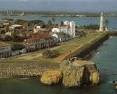
Main article: Portuguese CeylonAfter lasting for over 400 years,the Dravidian-influenced Jaffna Kingdom finally lost its independence to the Portuguese in 1621. The Portuguese captured the King of Jaffna Sangili Kumaran and took him to Goa in India along with his sons. After the trial, the Portuguese found him guilty of treason and hanged him along with his sons. With the Jaffna Kingdom’s demise, the only indigenous independent political entity that was not Sinhalese and Buddhist in character came to an end in the Island. The Portuguese built the Jaffna Fort and the moat around it.[edit] Dutch colony
Main article: Dutch CeylonThe Tamils and the Kandyan Kingdom collaborated and conspired with the Dutch rulers of Batavia (today's Jakarta in Indonesia). The Dutch invasion from Batavia brought religious freedom for Tamils and Muslims.The Dutch and later the colonial English ruler reigned for approximately three centuries, with each ruling for approximately 150 years. The Jaffna Tamil has several Portuguese and Dutch words still in usage.During the Dutch rule the islands of the Palk Straits were renamed after Leiden, Kayts and other cities in the Netherlands. The Dutch priest Rev Philippus Baldeus wrote a great historical record similar to Mahawamsa on the Jaffna people and their culture and it was immediately published in Dutch and German with several beautiful pictures. A granite stone inscription at the Point Pedro Market Square still marks the place where Rev Baldeus preached to the Tamils under a big tamarind tree. This tamarind tree was uprooted during the cyclone of 1963.[edit] British colony
Main article: British CeylonWith the Treaty of Amiens all maritime territory under Dutch rule became apart of the British Crown. This included the what is today, Jaffna district. In 1815, the Kandyan Kingdom was brought under British with signing of the Kandyan Convention.British rule began in 1798. Many educational institutions were established during this period. The English language was taught to the locals. The Jaffna Tamils were given higher ranks in government institutions. At this time American missionaries and Anglican missionaries were in close competition with Catholic missionaries in establishing churches and schools in every nook and corner. The Hindu Board of Education in turn established its own network of schools. Several high schools and western style education became the hallmark of Jaffna. Jaffna Tamils became loyal subjects of the ever-expanding British Empire and took the middle-level positions in public service throughout the South East Asian countries of the British Raj (Burma, Malaya, Borneo and Singapore) in the late 1800s/early 1900s.[edit] Christian missionary activity
Main articles: Jaffna Roman Catholic diocese and American Ceylon MissionJaffna also played an important role in the Roman Catholic religious administration of Sri Lanka. It also plays an important role in the administration of the Church of South India in Sri Lanka, a group of Protestant denominations.[edit] Ethnic conflict
Main articles: Ethnic conflict in Sri Lanka and Human rights in Sri LankaDue to the civil war, the city has witnessed wholesale massacres, disappearances of the civilian population and a deterioration in the human rights situation. Currently it is occupied by the Sri Lankan Army, with full government control; between 1992 and 1995 it was under the control of the LTTE before that the Indian Army IPKF had captured it first in 1989 and handed over to Sri lankan Army after a hard fought battle before its withdrawal from Sri Lanka. Due to ethnic conflict in Sri Lanka, many residents moved out of the city, and thus the population was reduced dramatically. According to the 2001 census, the population of the municipality is about 145,600[citation needed]. The population of the district is currently estimated by the district administration at 600,000. Jaffna also functions as the economic and cultural capital of Sri Lankan Tamils.Jaffna was once a stronghold of the Liberation Tigers of Tamil Eelam (LTTE), a separatist outfit that seeks to set up an independent Tamil Eelam for Tamil-speaking people in Sri Lanka. Jaffna currently is under the occupation of the government of Sri Lanka.The Jaffna Public library was burnt down by an organized mob in June 1981, when ethnic tensions in the country were building steadily towards war. The Sri Lankan government (United National Party) at that time was accused of letting the paramilitaries loose in Jaffna, following an incident where two Sinhalese policemen were killed by a Tamil group. The library was renovated in 2003 by the government of Sri Lanka.[3][edit] Mass exodus and ethnic cleansing
Main articles: Sri Lankan Tamil diaspora and Expulsion of Muslims from JaffnaMany of the Tamils from this region moved out to other parts of the island or to foreign countries. This exodus of Tamils from Jaffna occurred for a number of reasons.The entire Muslim population of Jaffna was forced to leave within 48 hours in 1990 due to an order by the LTTE allegedly to avenge the ethnic cleansing of Tamils in the East. The mass exodus of Tamils from Jaffna to Vanni is another significant incident in the history of Jaffna. When Sri Lankan Army captured Jaffna from LTTE occupaton in December 1995. Nearly 450,000 Tamils displaced during at that time.[4] There have been claims of human rights violations on both sides. Due to Jaffna becoming a constant battleground between the Sri Lankan military and the LTTE, many people have been displaced. The tight security measures loosened as the war ended.[edit] Demography
Main article: Sri Lankan Tamils85% of the population of the Jaffna and Kilinochchi districts are Hindus. The Hindus follow the Saivite tradition. The remainder are largely Roman Catholics or Protestants, some of whom are descendants of colonial settlers, known as Burghers. The Tamils are divided along caste lines, with the farmer-caste Vellalar forming the majority. However, there are many Caste divisions within the Vellalars and they vary in social status, with various Saiva Vellalars usually on top. The maritime caste known as the Karaiyar dominates the coast. The Karaiyar caste is seen as inferior due to their ancestral profession as fisherman, and due to their lower caste in terms of the ancient Hindu Varna system.Sri Lankan Tamil is the major language spoken in Jaffna by the vast majority of the population. The other language spoken is Sinhala by 1 percent of the population. English is widely spoken and understood in the cities. Tamil and Sinhala is official language of the Sri Lanka. Tamil is the official language and administrative language of the Northern Province.[edit] Culture
Nallur Kandaswamy Kovil, Jaffna.
Nallur Kandaswamy Kovil, Jaffna.Most Jaffna Tamils belong to the Dravidian culture, thus, Pongal, the Hindu New Year in April, Deepavali, Navaratri and Shivaratri are some of the religious festivals celebrated, see Culture of Sri Lanka.Arts The traditional dance of the Sri Lankan Tamils is called Kooththu. These are a variety of stage dramas. Karthavarayan Kooththu, Sangiliyan Kooththu and Poothaththambi Kooththu are some of the famous Kooththus in Jaffna. The Poothaththambi Kooththu has been staged from the Dutch era. These arts are mainly focused on the historical values of the community and to entertain the people. The villuppattu is one of the famous arts of the tamils. Oyilaattam is a notable variety of dance in the Jaffna peninsula. The South Indian dance and music is also indigenous to Jaffna. Noteworthy here would be Bharata Natyam and Carnatic music - the classical high traditions of Hinduism.Literature
Main article: Sri Lankan Tamil LiteratureA poet called Eelattu Poothanthevanar is mentioned in the ancient Tamil Sangam in Madurai. He was most probably from the North of Sri lanka. The Chief Nalliyakodan of Mantai in what is today Mannar sponsored several Sangam era poets in the Tamil land. Kumanan, another chief from Kudiramalai, also sponsored poets. However, the precise identity of Nalliyakodan and Kumanan is under doubt. This is discussed in Mudaliyar C. Rasanayagam's "Ancient Jaffna".The medieval Tamil court in Jaffna had produced some rare manuscripts on astronomy or ayurveda.
Public Library, Jaffna.Turning to modern times, Arumuga Navalar was born in Nallur in December 1822. He died in 1879. He helped develop modern Tamil prose and freed the language from what had become the stilted classicism of the past with his freer use of words. He translated the Bible into Tamil and then researched Hindu doctrine. Navalar wrote many Hindu religious books and was an outstanding orator. He was the pioneer of religious reforms in the Jaffna Hindu society. C.W Thamotheram pillai, another native of Jaffna, was one of the first two graduates in the Madras Presidency. He obtained his degree from the University of Madras in 1858 and contributed to Tamil studies. Dr. Ananda Coomaraswamy contributed extensively to the study of Indian art in its social context. He was born in 1877.Mallikai, Sudar, Samar, Siriththiran, Alai and Kathambam were some of the Tamil magazines published in the 1970s. Many of them disappeared after the ethnic tension in the late 1980s.The term Pulampeyar Ilakkiyam refers to the literature of the Tamil speaking people who migrated away from their native region. Viduthalai Ilakkiyam is the literature of various Tamil nationalist organizations.Media The first newspaper in Jaffna, Uthayatharakai (Morning Star) was published in 1841 by C.W. Thamotharampillai[5] By the 1940s, daily newspapers had already been started Eelakesari and Virakesari in 1930 and Thinakaran in 1932 and journals committed to the growth of modernistic, socially purposive literature Bharati and Marumalarchi in 1946 had also started coming out.Few newspapers are published in the province now in the principal language of Tamil. None in English and Sinhala. Before the Civil war commenced dozens of newspapers and magazines were published.[edit] EconomySea products, red onion, and tobacco are the main products in Jaffna. Prior to the civil war it was a place of many small scale industries manufacturing household items as well as packaging and food processing for export. Most industrialists have left or closed shops. The present Jaffna economy is facing setbacks because of the unstable connectivity with the south. The prices of goods in Jaffna are relatively high compared to the south. Currently the primary economic activity is trade. The foreign remittance from the Sri Lankan Tamil diaspora sustains many people.Jaffna Harbour The pending Sethusamudram Shipping Canal Project may increase the productivity of the Jaffna Harbour. Enlargement of the harbour will bring benefits to Sri Lanka. However it might damage the ecosystem of the area. The strategic advantages derive from obtaining a navigable sea route close to the coast, with a reduction in travel distance of more than 350 nautical miles (650 km) (for larger ships). The project is expected to provide a boost to the economic and industrial development of coastal Tamil Nadu in India. The project will be of particular significance to Jaffna, Kankesanthurai, Mannar, Point Pedro and Tuticorin harbour.[edit] Education
See also: List of Secondary Schools in Northern Province, List of Private Schools in Northern Province, and University of JaffnaJaffna is considered to be the most literate district in the whole of Sri Lanka[citation needed] (whose national literacy rate in 2001 was 90.7%[6]). In the early days (before 1970s') Sri Lankan universities were dominated by Jaffna students but currently their enrollment numbers are minimized due to the effects of a district based quota system introduced in the 1970s as well as the effects of the civil war. However, in 1974 the government opened the University of Jaffna which is de facto reserved for students from the region, while they have a quota based access to the other Sri Lankan universities as well.Peter Percival was a Wesleyan Missionary who started several schools in Jaffna including Jaffna Central College, Hartley College, Vembadi Girls School, and the Methodist Girls High School. The first translation of the Bible into Tamil was carried out by Fr Peter Percival and Arumuka Navalar.[citation needed]The Jaffna Hindu College is one of the leading schools in Jaffna. This institution was established by a Hindu asscociation in 1890. The Hindu Board of Education established a network of grant-in-aid schools. Sir Ponnambalam Ramanathan established Ramanathan College for Girls and Parameshwarar College for Boys.Founded by American missionaries in 1819, Jaffna College has records of Malaysia, Singaporean, South Indian and even Japanese students enrollment in the 1930s and 1940s. American missionaries also founded many other institutions of higher learning that are still functioning today.[citation needed] Today most students are locals.Jaffna is now considered a backward district for university admission by the University Grants Commission. While district quotas once kept down Jaffna numbers at the universities, today they are increased by the same quotas because of poor performance from Jaffna. Peter Percival arrived in Ceylon in 1926 after Central College was founded. He reorganized the school in 1936 or so.Contributions by Jaffna Tamils The first full translation of the Bible was in Tranquebar in 1723 succeeding partial versions earlier. This Tamil Bible was translated by Bartholomäus Ziegenbalg and Benjamin Schultze. The translation of Fabricius followed—the New Testament in 1772 and Old Testment in 1791. The Jaffna version was by a six member committee, headed by Peter Percival, Principal of Central School. Jaffna at that time had a tremendous fund of scholarship from which to draw, both on the side of Western missionaries as well as on that of Jaffna Tamils. The other missionaries were Levi Spaulding, H. R. Hoisington, Samuel Hutchings, Daniel Poor and Miron Winslow. They knew Hebrew and Greek to translate. Arumuka Navalar was merely one of at least 2 Pandit Assistants who simply put the missionary translation into good Tamil—interestingly a form of Tamil that was soon rejected in Jaffna itself and a new translation modelled on the Tamil of Fabricius is what we use today in Indian and Sri Lankan Churches. Navlar had very limited eudcation and could not be credited with the scholarship and methodology required for serious translation. As the front page of the 1850 Bible says, "Translated out of the original tongues and with former translations diligently compared and revised." Thus the translators themselves do not claim to have made the first translation and this claim comes only from sectarian groups in Jaffna. The Americans founded only one institution of higher learning—Batticotta Seminary
 Hetauda (हेटौडा) is a small town and municipality and seat of Makwanpur District in the Narayani Zone of southern Nepal. At the time of the 1991 Nepal census it had a population of 53,836 people living in 10,420 individual households.[1]It is 132 km from the capital Kathmandu via the old Tribhuwan Highway. There are now two alternate roads that are less than 80 km. They are, however, not black topped yet. The city is enclosed by three rivers, the Rapti to the west, the Samari to the north and the Karra to the south. It is one the important industrial regions of Nepal. The settlement could have started due to its location at the meeting point of two major highways - East-West Highway and Tribhuwan Rajpath.


 Main article: Katirkamam (Hindu temple)Tamil Hindus of Sri Lanka and South India refer to the place as Katirkamam and it has a famous Hindu shrine dedicated to Lord Katirkaman. The presiding Deity is Lord Murugan or Skanda. Saivite Hindus of South India call him also as Subrahmanya. Following are the other names to identify the same God in the Hindu texts; Kandasamy, Katiradeva, Katiravel, Kartikeya, and Tarakajith. Some of these names are derived from the root Katir from Katirkamam. "Katir" means formless light.The Deity is depicted either with six faces and twelve hands, or one face and four hands. Out of love for Lord Murugan and to mitigate bad karma, bhaktars pierce their cheeks and tongues with vels, pull large chariots carrying murthi of Murugan with large hooks that have been pierced through the skin of their backs. This practice is known as kavadi. Murugan's vahana or vehicle is Mayil, the peacock. There is also a related shrine called as Sella Katirkamam dedicated to the beloved elephant-faced God Ganesha nearby, who is known as Lord Murugan's elder brother.The local river namely Manik Ganga or Manika Gangai (River of Gems) functions as a place of ablution where a sacred bath is taken to purify oneself. Local residents declare that one can be healed of ailments by bathing in it not only from its high gem content but also the medicinal properties of the roots of various trees that line the river through the jungle.[edit] Buddhist Kataragama[hide]